Skippers Lane. TS6 0HY.
N54:33:22 / W1:09:56
AKA: ‘The Lines’
My initial interpretation;
Skippers Lane is a humble place, of working class people. It hosts home to the standard society, who are in line with what’s expected from modern day families. It’s a structured area, visually and metaphorically. Known as ‘The Lines’ due to it’s history. It’s a well known street in the local area, but one who’s history is often forgotten about, despite being nicknamed around it and a well travelled street daily.
Reasoning for this street;
Originally I picked this street for the personal memories it had to me and connections to my life. More based around personal links and feelings. Then I remembered the historical side of the street. If you ask locals ‘Do you know Skippers Lane?’ often it’s a ‘kind of’ or ‘a little bit’ answer, if you say the nickname of Skippers Lane ‘Do you know the lines?’, it’s often an instant ‘Oh yes!’…
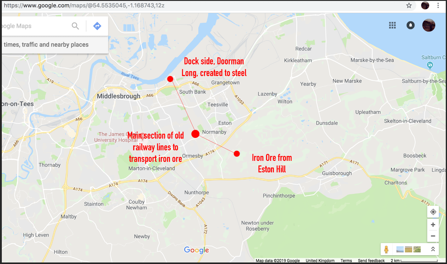
I could go on about the historical connection in so much depth, including old photographs and archives I’ve came across. But I’ll try keep it short and precise. I’ve already mentioned in previous week’s tasks about Middlesbrough Steelworks history. Well, it all started in the ‘hills’ approx 4 miles away from Skippers Lane, where the iron ore was discovered, then transported via railway to the docks at South Bank to be created into the steel that has been used around the world. Why is this important? Because Skippers Lane street is part of the old railway system that transported the iron ore to the docks – hence the nickname for the road of ‘the lines’, shortened from ‘the railway lines’. But overall ‘Skippers Lane’, is a stretch of land that runs beyond the actual street.
Skippers Lane actually continues right down to the docks still, but is spilt up via walking paths / fields, then an industrial estate known as ‘Skippers Lane Industrial Estate’. 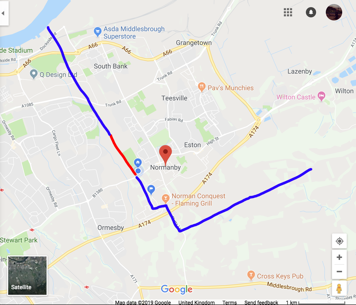
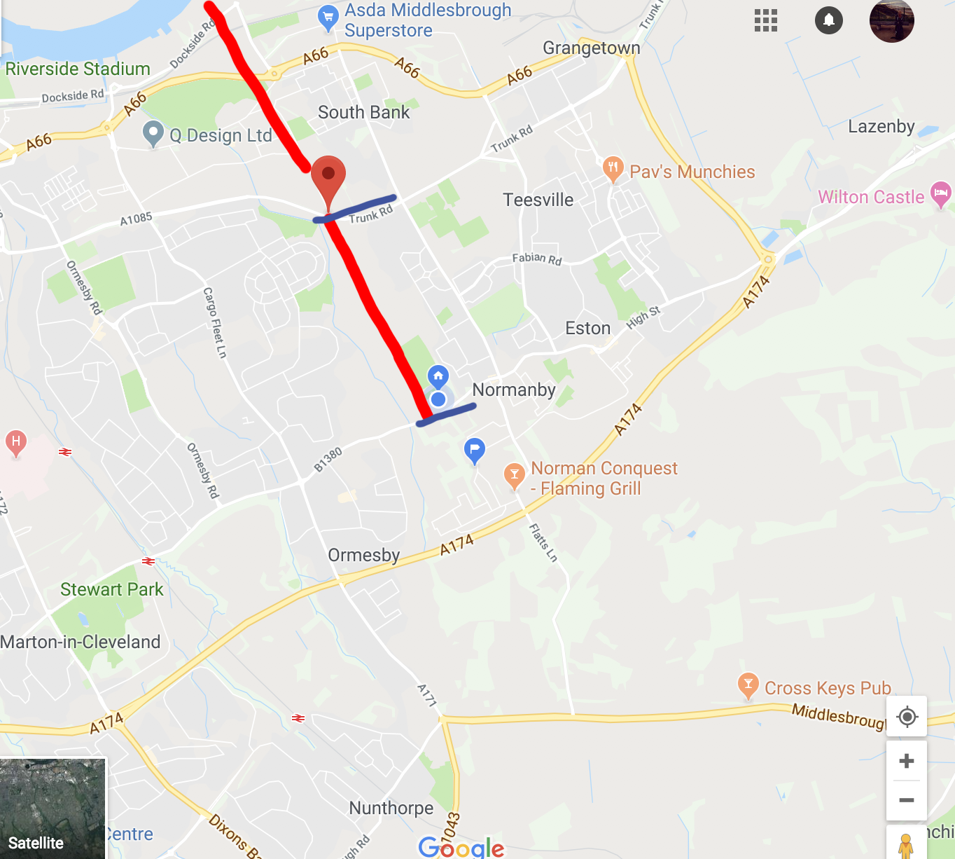
This shows a rough guide to the original railway route. The right line indicates the main Skippers Lane road that I am focusing on, beyond that towards the river is the fields / bridal paths and then into the industrial estate 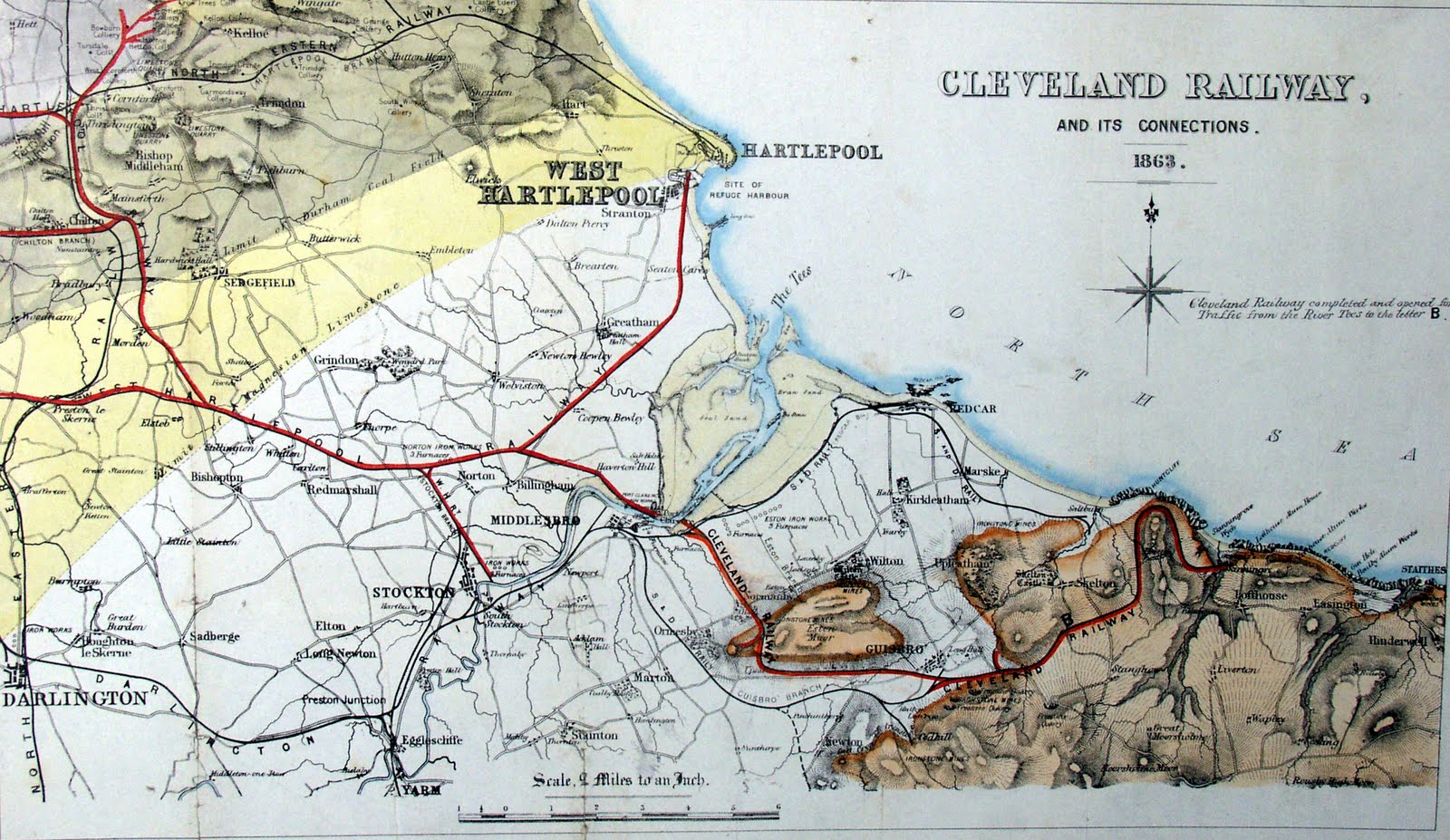
Original Cleveland Railway, of which mining trains joined to travel via Skippers Lane to the docks (https://en.wikipedia.org/wiki/Cleveland_Railway_(England)) 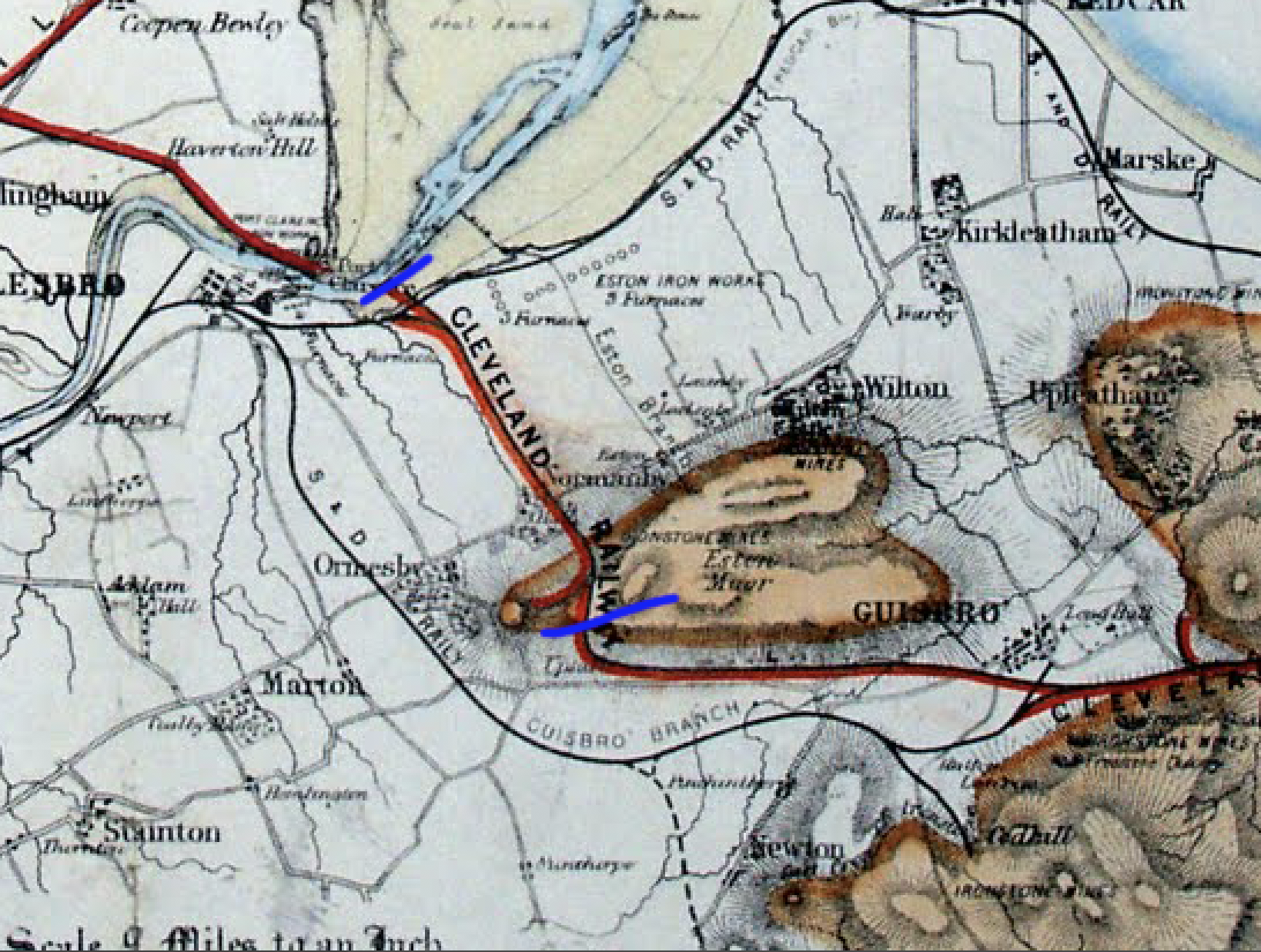
Zoomed in guidance – approx the section of the Cleveland Railway which the mine trains would join to get to the docks, via skippers lane (https://en.wikipedia.org/wiki/Cleveland_Railway_(England)) 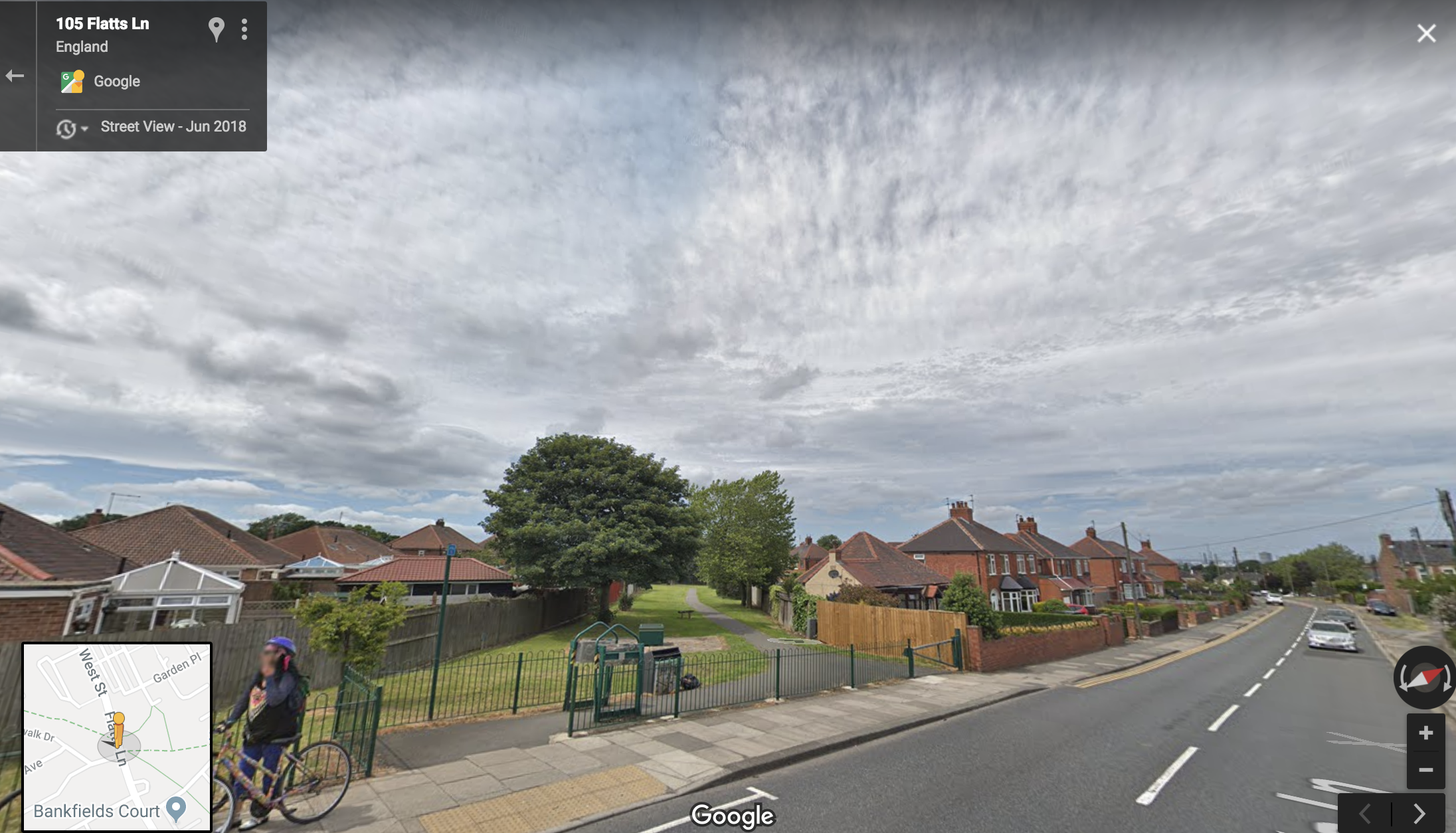
This is the top section of the original railway that leads to Skippers Lane. The ‘Lines’ mix between, street, cuts / bridal paths, fields and industrial estate. 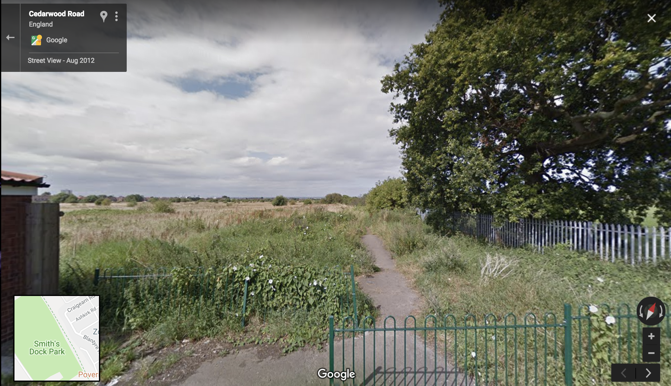
Bottom end of Skippers Lane street, which leads to the fields / bridal path part of the railway route
OBSERVATIONS AND DOCUMENTATION
Taken over the space of 2 days at different times. I managed to collect around 100 photographs but narrowed down to the most interesting or important. I was hoping to do some rubbings to gather textures, but the weather decided to open the heavens.
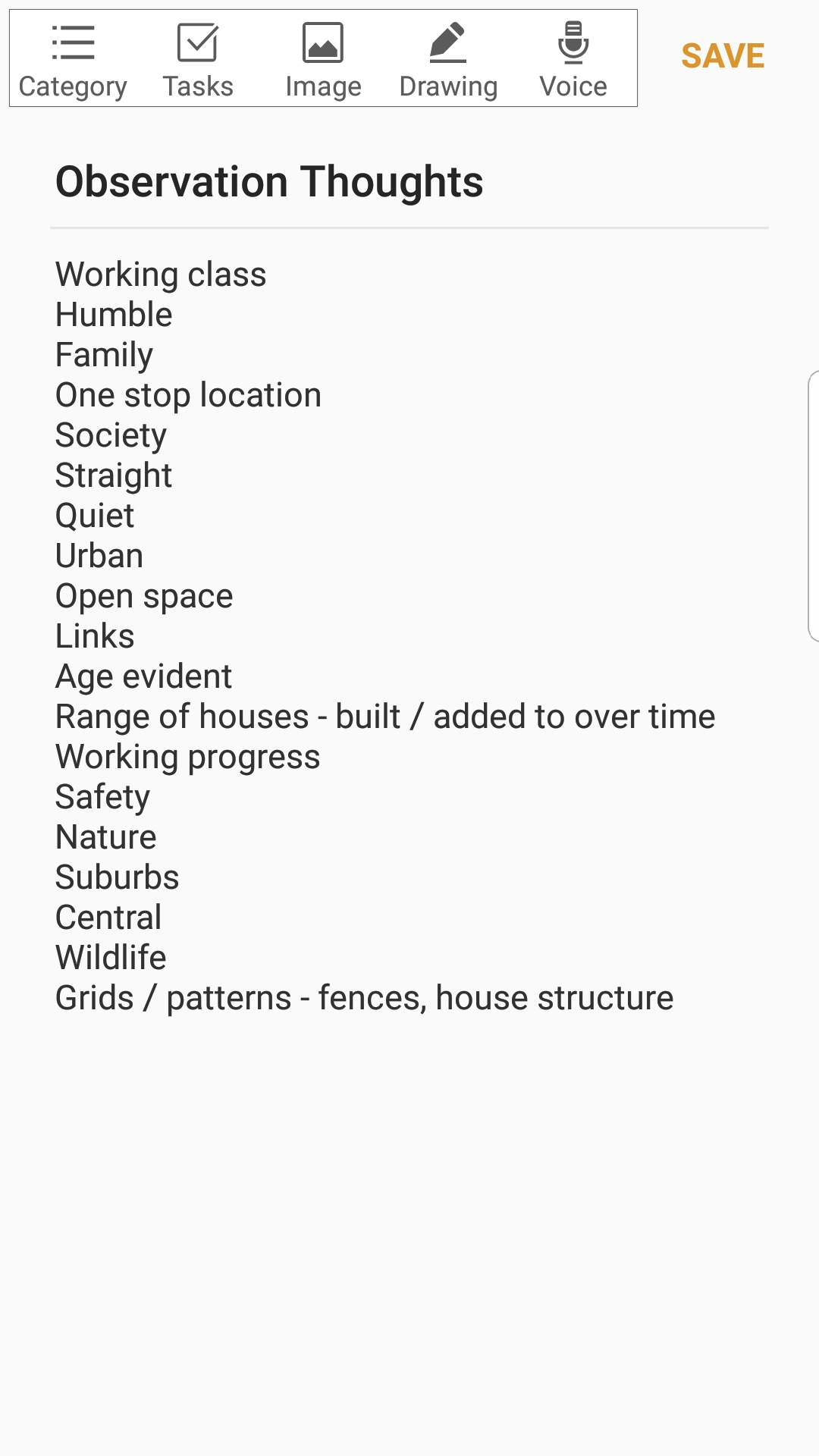
What I noticed whilst driving, walking, photographing and drawing Skippers Lane;
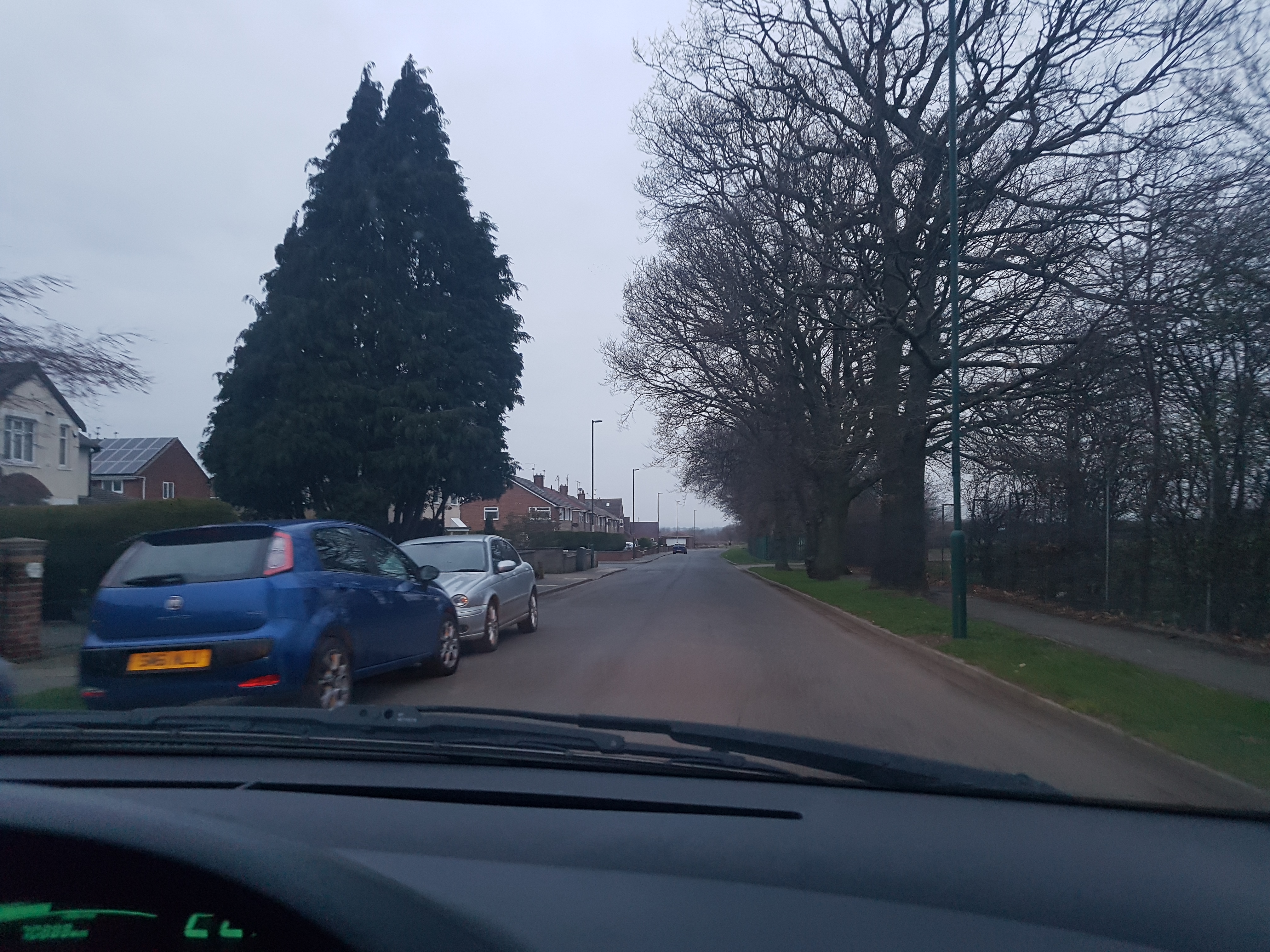
– Lots of structure and line work, in pavements, brick work, fences, drive ways. Lots of straight elements
– The houses range in style massively
– The street is approx 0.4 miles, but hosts a range of community elements, such as the local junior football team, bowling club, a pub, as well as over 100 family homes
– A crack appeared on the bottom half of the streets pavement and continued for quite a duration
– Older elements such as trees have been ‘built’ around
– The whole area has a working class and humble approach. A place you don’t move far from
– This street has a lot of personal memories from when I was in Secondary School, lots of summer nights on the Smiths Dock Park, summer 2008 was a year that regularly gets brought up as the ‘best summer ever’ – feelings and emotions
– There is a LOT of little details I had never noticed before, such as the drains and royal mail box
5pm UK time (March 1st) 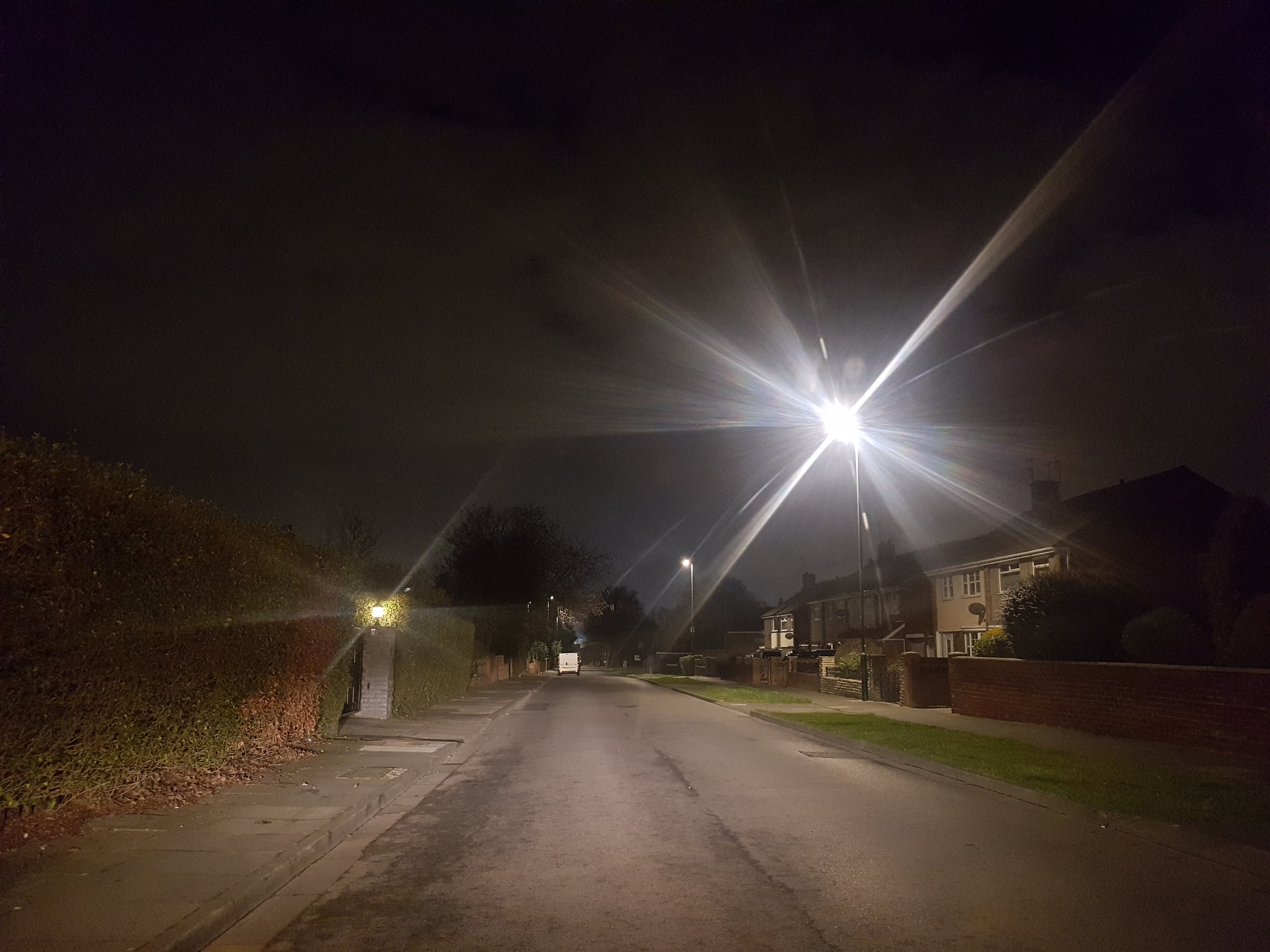
7.30pm UK time (March 1st) 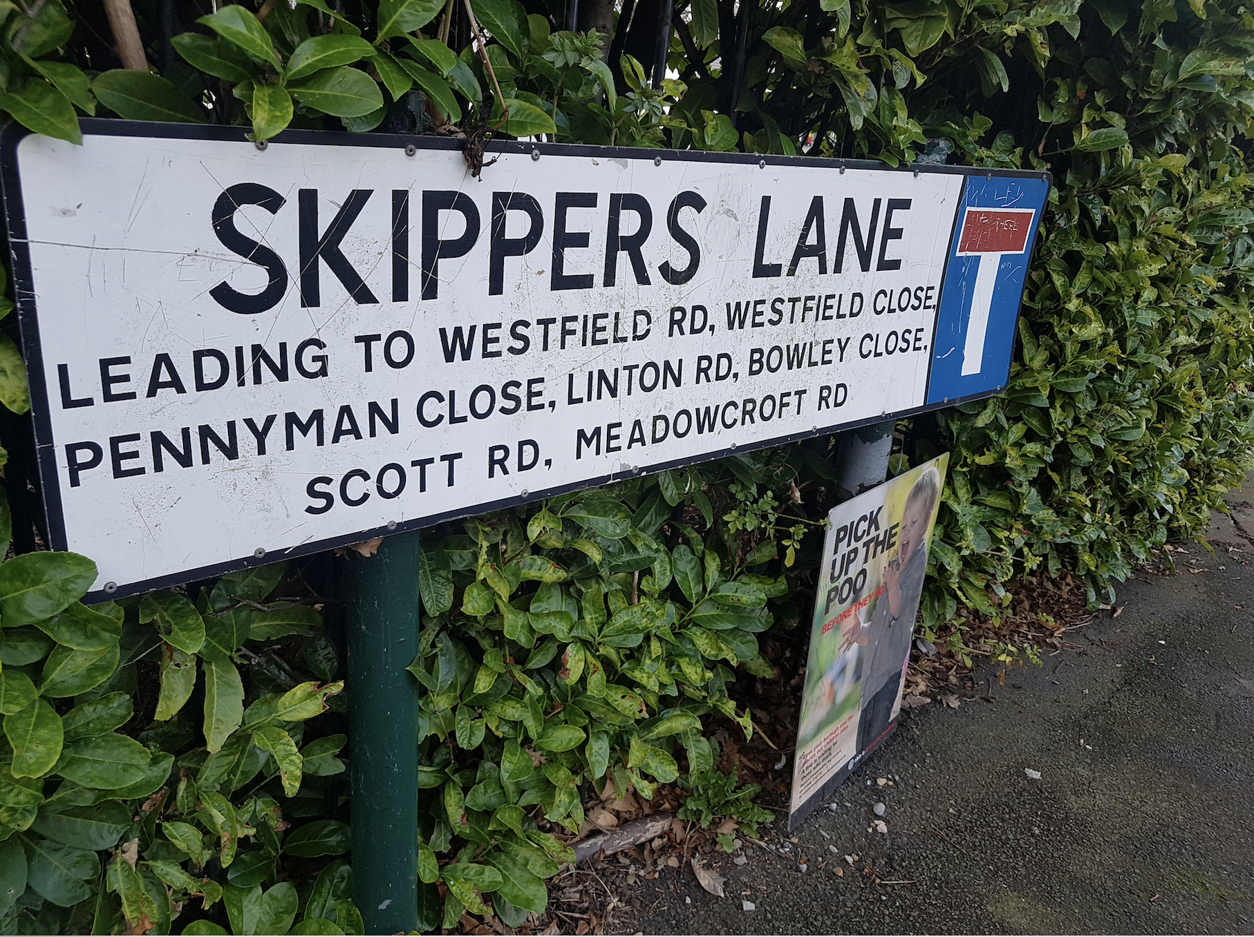
Street sign – Skippers Lane is a ‘main street’ to several cul – de -sacs. 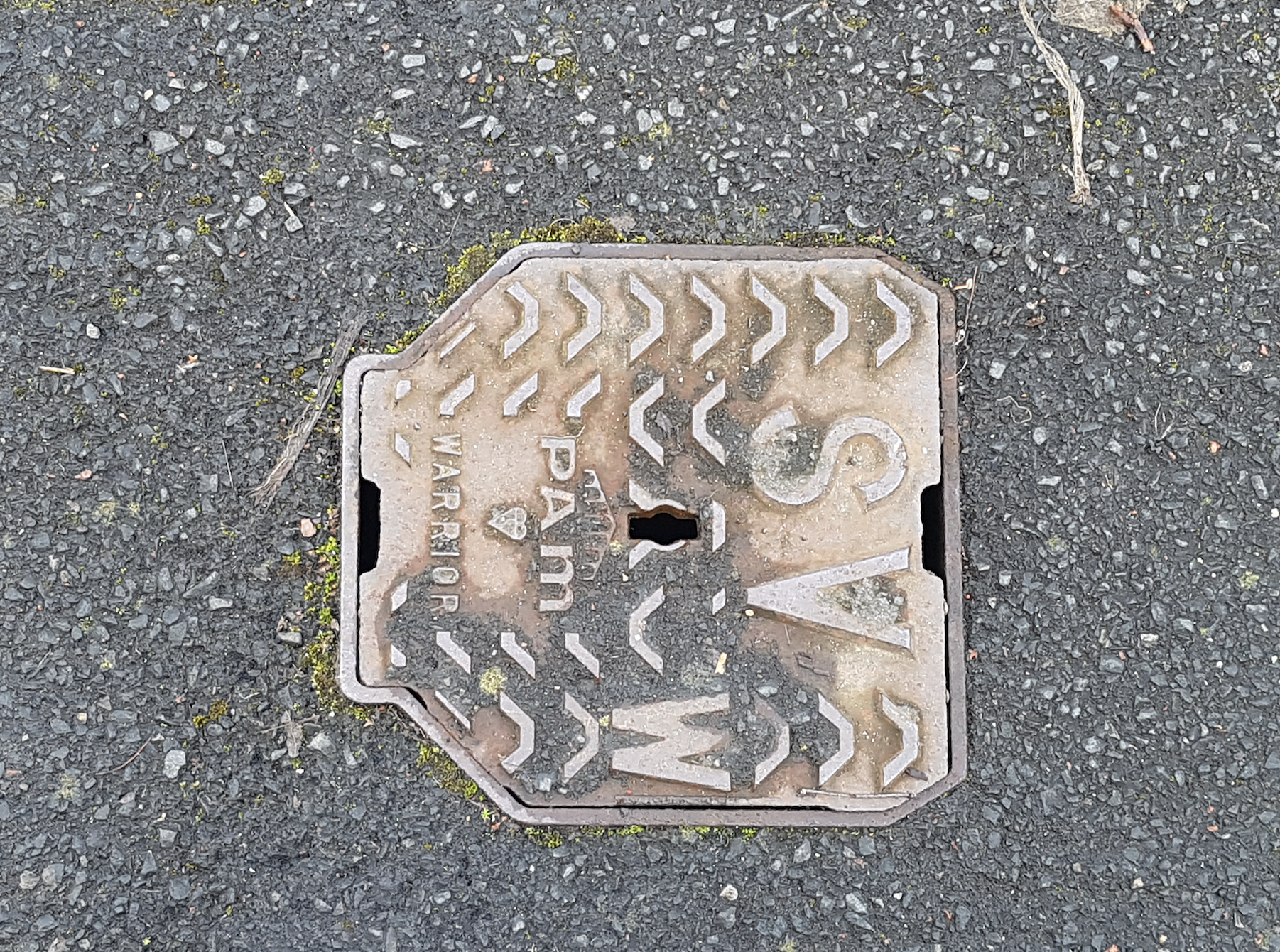
All the drains have ‘Warrior’ branded onto them. Never noticed! 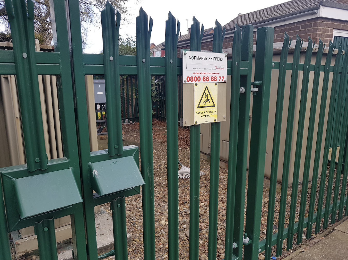
Providing electricity for the whole estate. Structured elements. 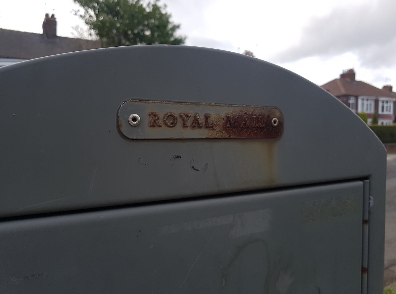
Walked past this for the last 17 years and never noticed it’s a Royal Mail item. 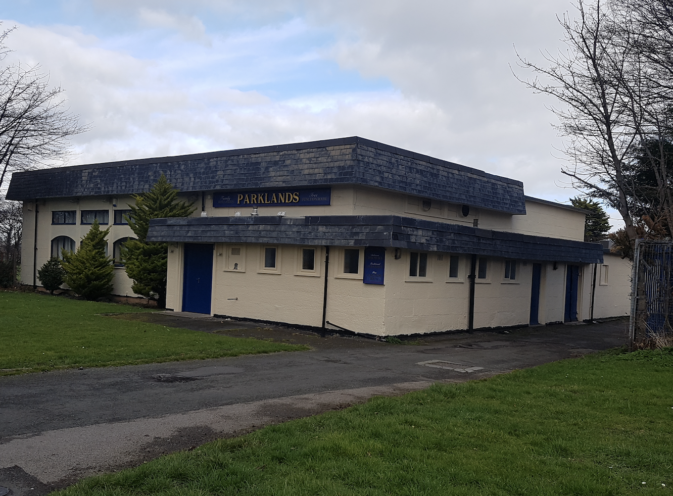
Local pub – sadly shut down this year due to bigger pubs opening in the area 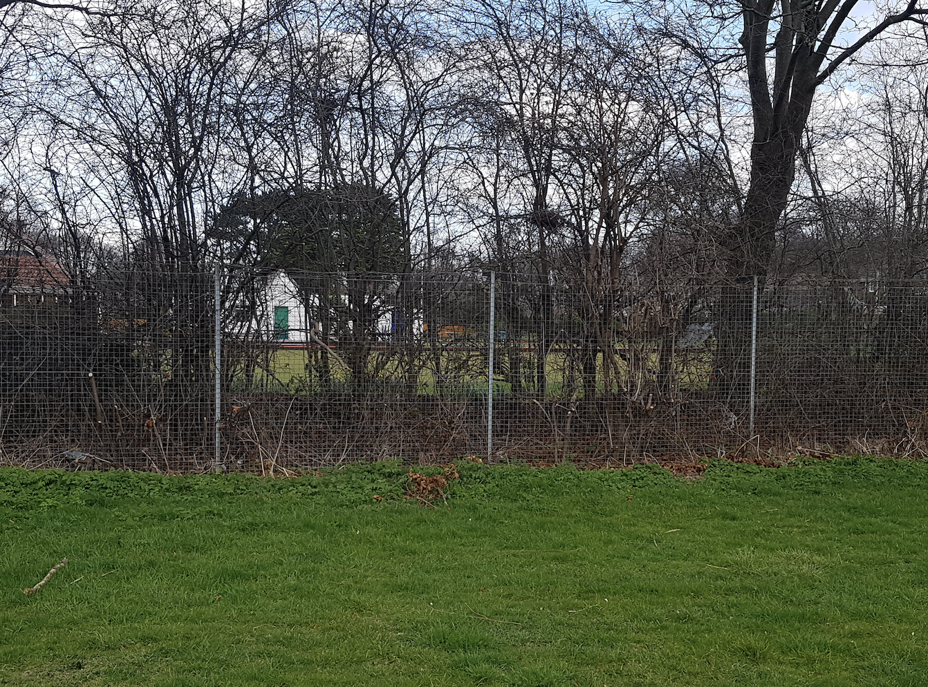
Bowling club 
Smiths Dock Park is home to the local junior football club 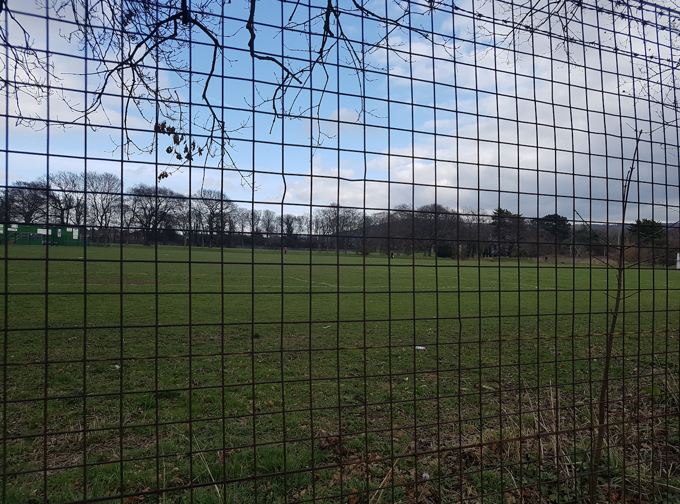
Smiths Dock Park, 4 cricket fields merged into one big piece of land. LOTS of childhood memories here ‘playing out’. 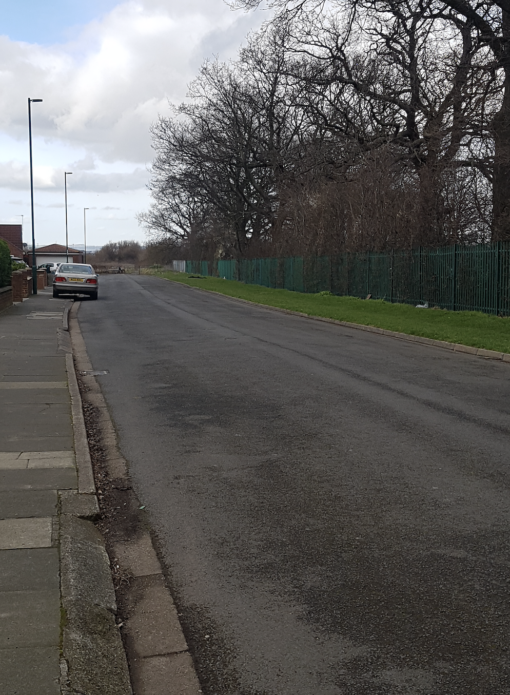
This shows where Skippers Lane suburb ends, leading to the fields and paths, which later joins the industrial estate. 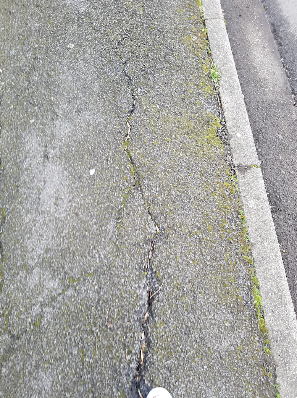
This crack appeared for the majority of the road length 0.4 miles. Metaphorical railway? 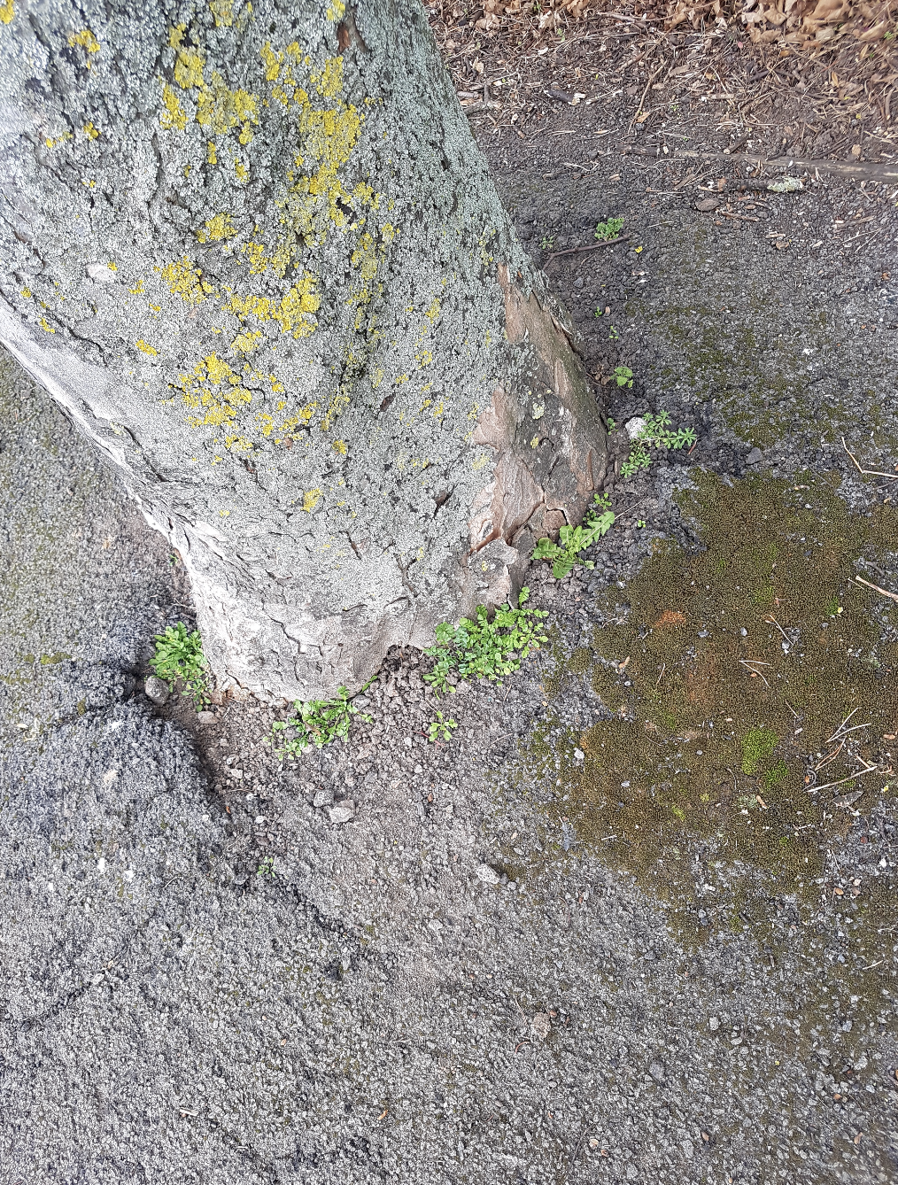
Who came first, the tree or the pavement? What’s the age of the tree? What has it seen? 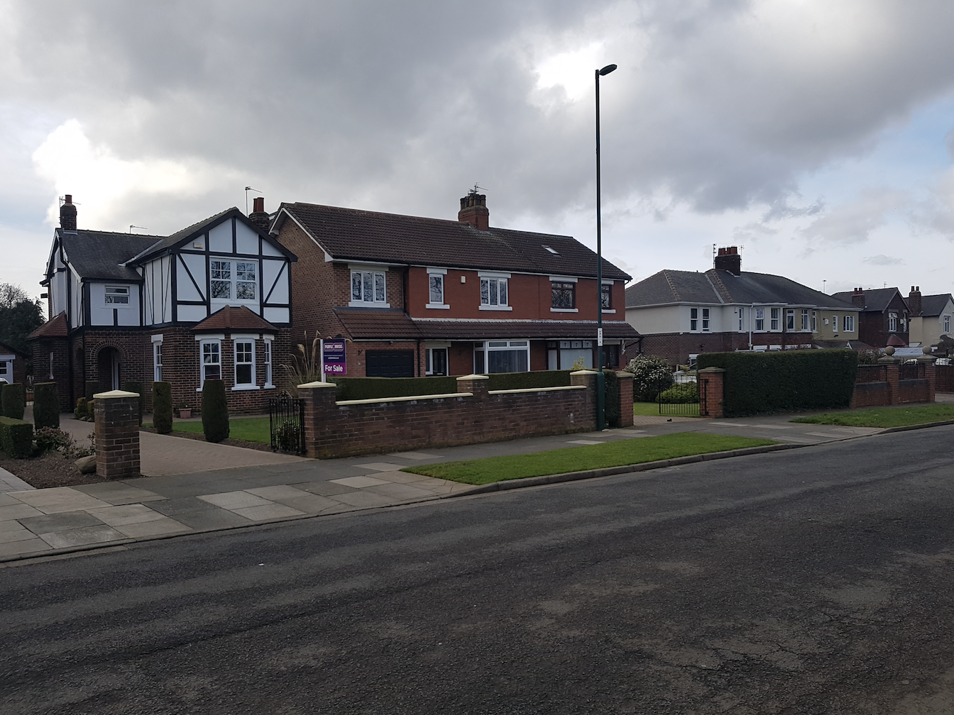
Example of different houses and building times 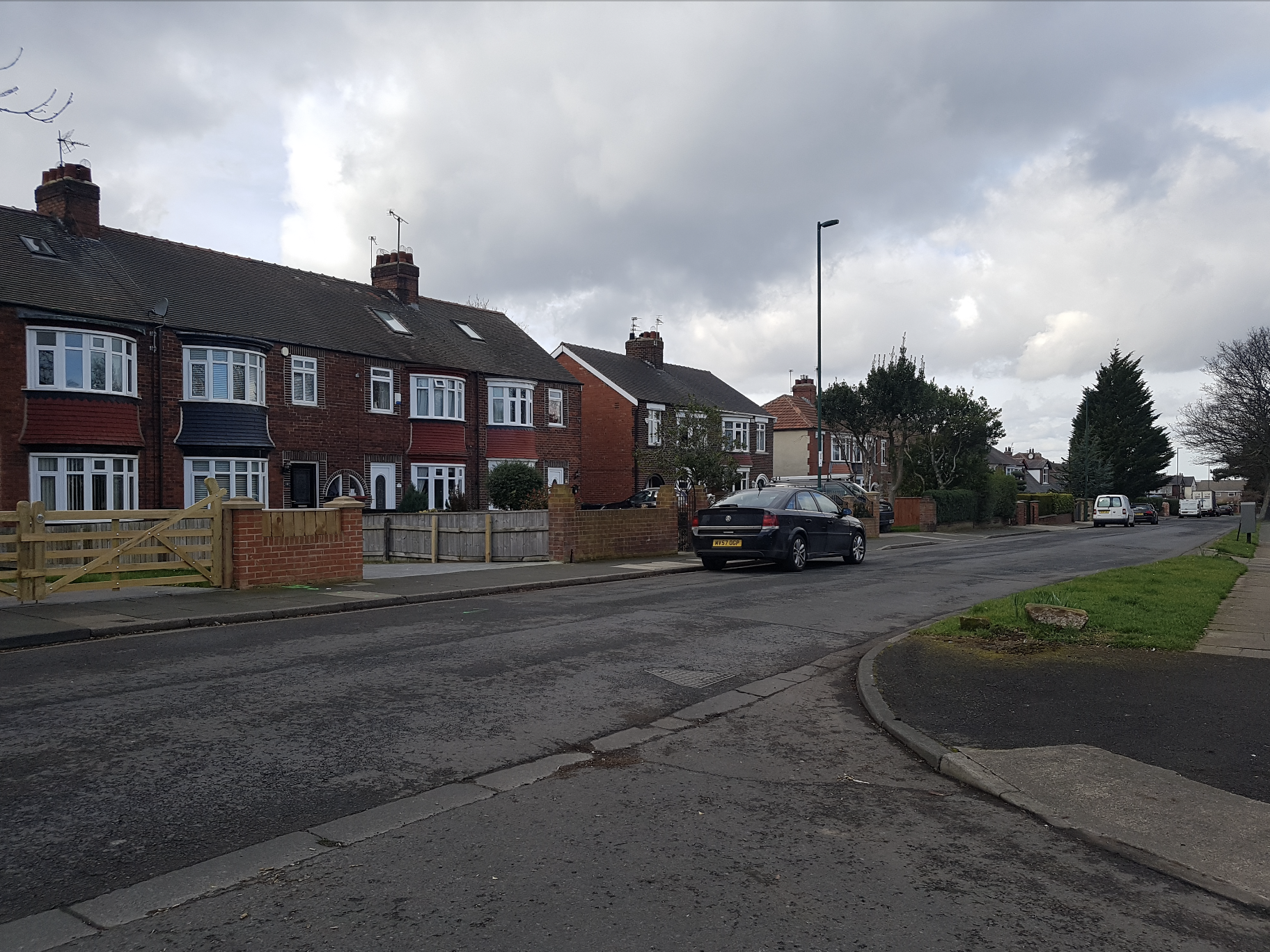
Example of different houses and building times 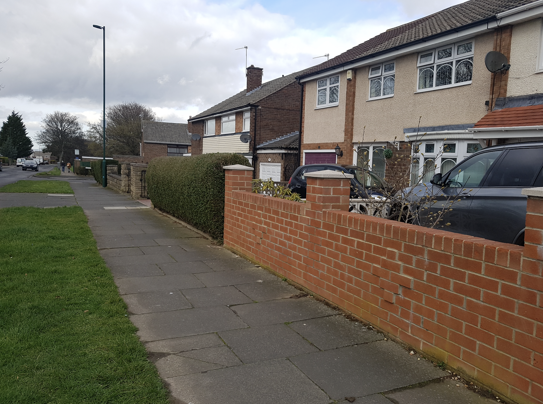
Example of different houses and building times
Thoughts whilst walking on street 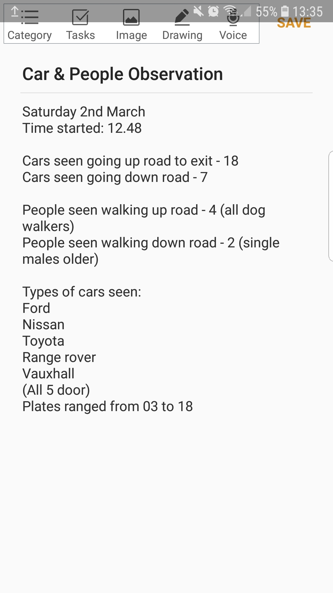
Time finished on bar of phone at top. Sat on grass outside pub to observe 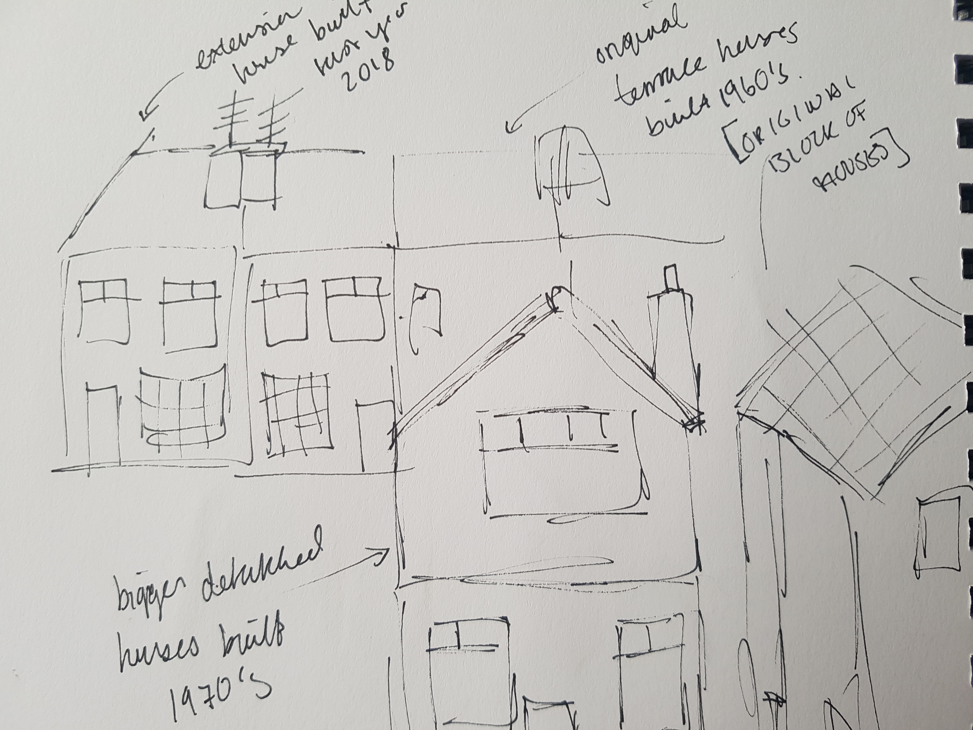
Different house styles throughout Skippers Lane sketches 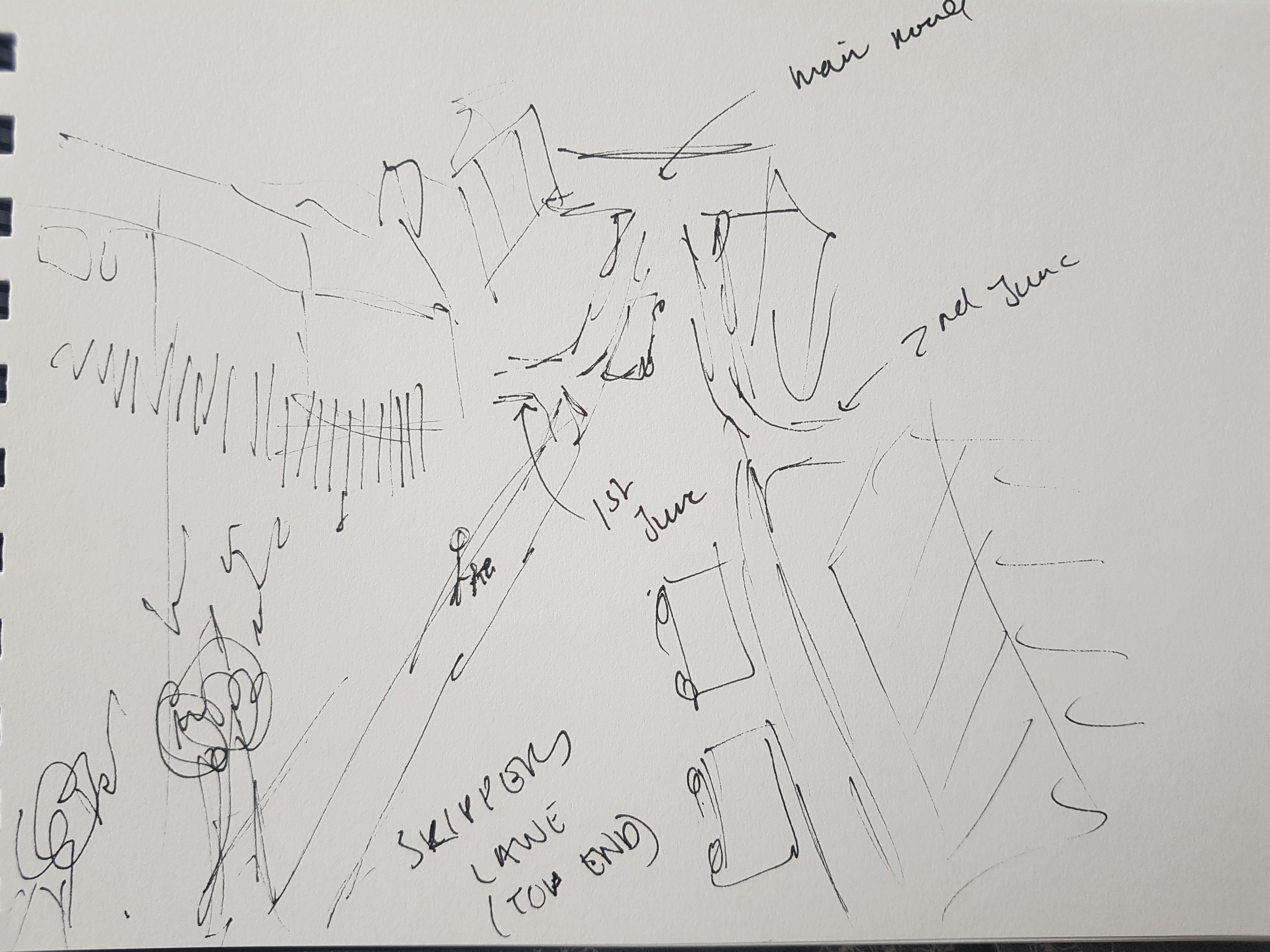
Rough sketch looking up to exit of Skippers Lane
THE PROCESS
The direction I wanted to develop on at first was trying to align the street history to my personal experience of the street, through the use of a structure system, such as lines, like Skippers Lane hosts many of I discovered from my observations. I knew I wanted some form of line format, but wasn’t sure what yet.
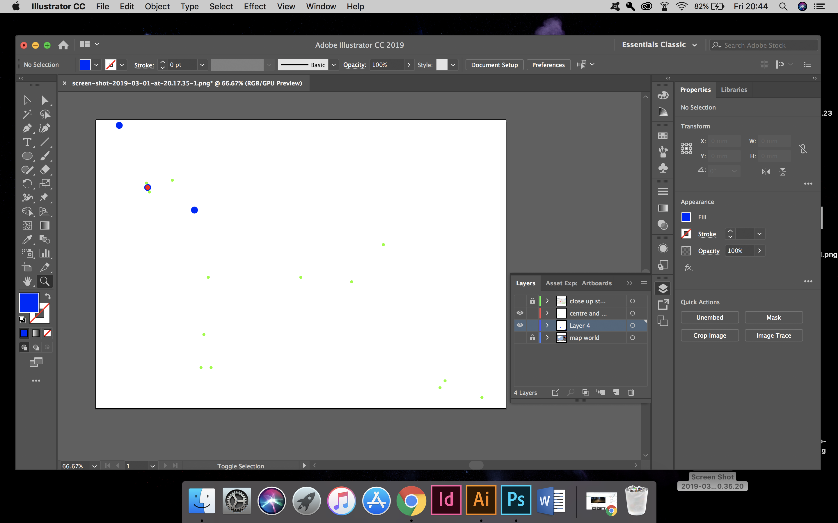
I began testing the personal side of Skippers Lane at a very basic level of just linking elements on Google maps and Photoshop via lines and dots, showcasing where my family are, educational places, friends, etc. I then began doing the same for the history aspect, showcasing where the iron ore (once made into steel after traveling down the railway on Skippers Lane), had made it’s way to in the world. Hoping somehow I could align them or they would showcase similar patterns.
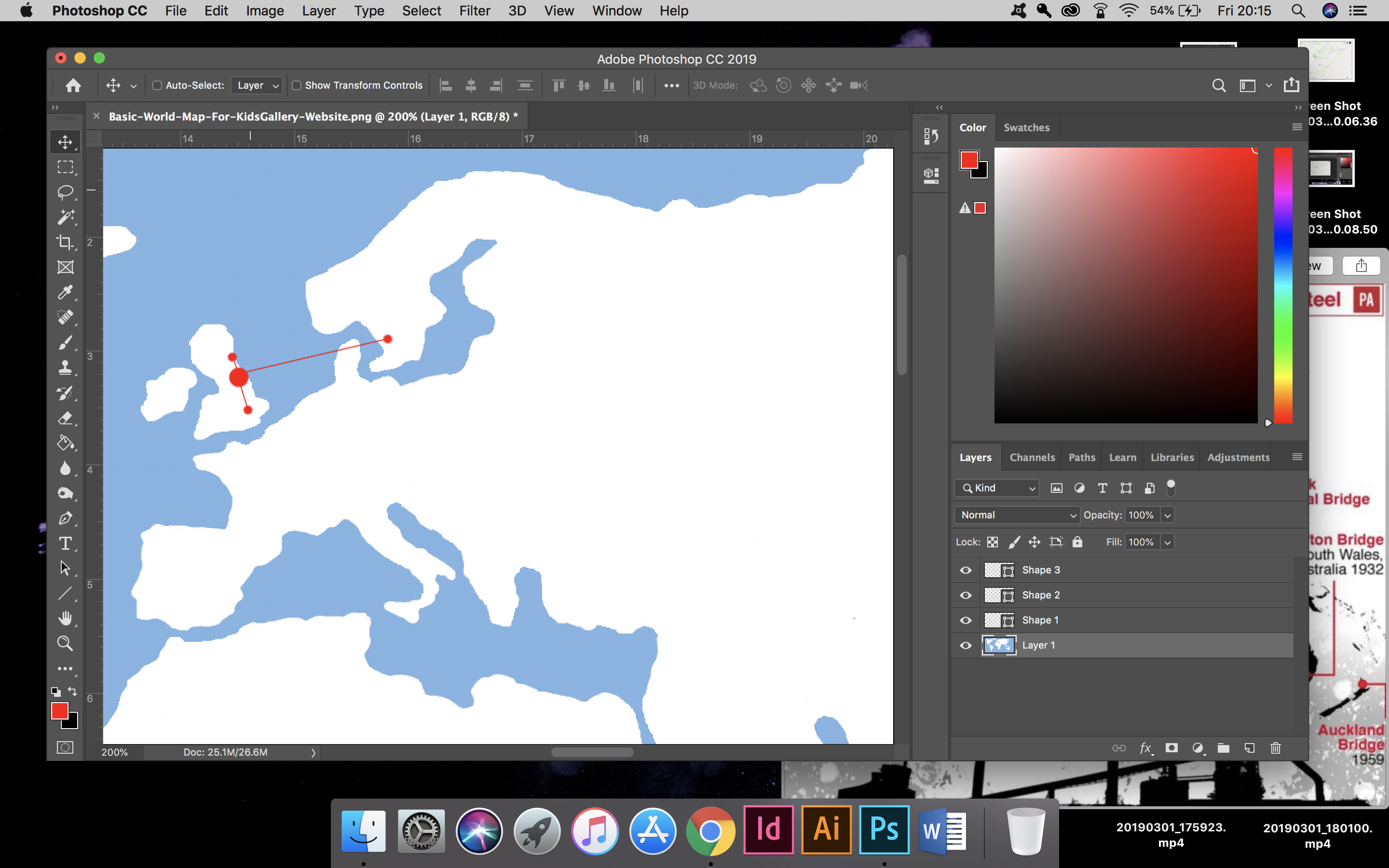
Beginning the world wide connection from Skippers Lane. 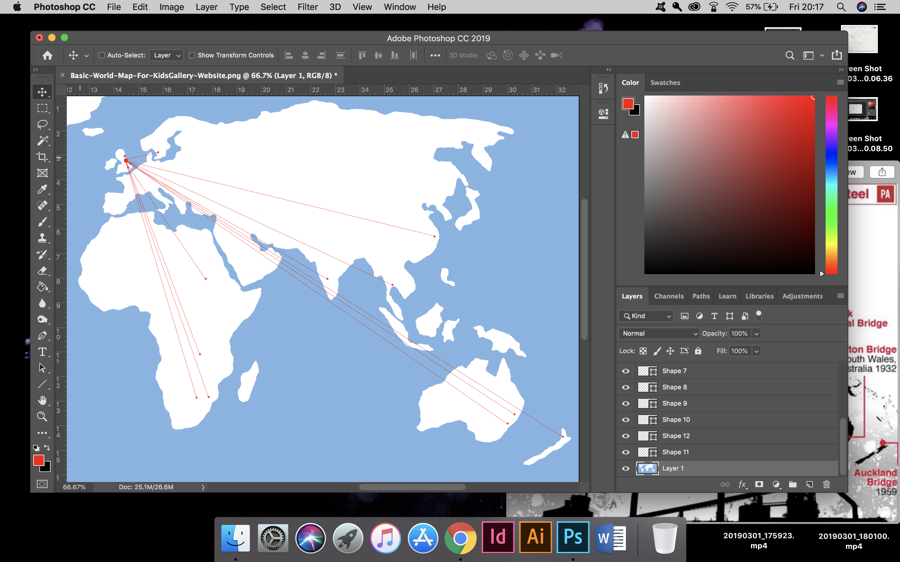
The world wide connection from Skippers Lane. 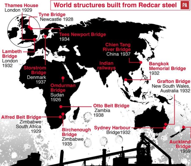
Leatherdale, D. (2015). The firm that bridged the world. [online] BBC News. Available at: https://www.bbc.co.uk/news/uk-england-tees-34389873 [Accessed 1 Mar. 2019]. 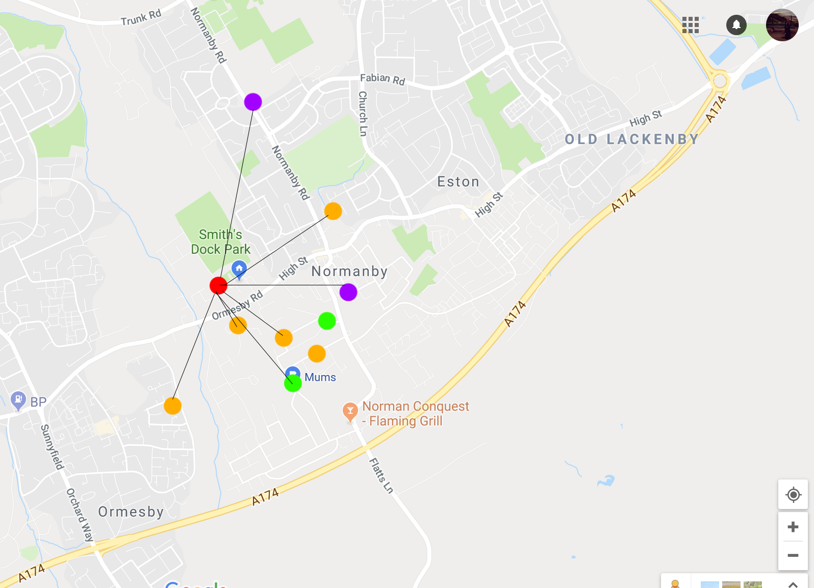
Personal connections to Skippers Lane, each colour representing a different element of my life 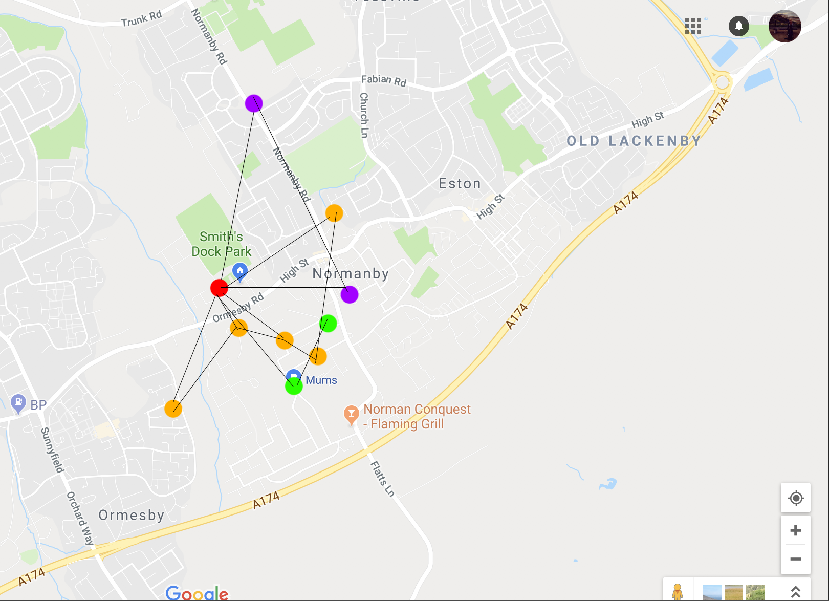
Personal connections to Skippers Lane, each colour representing a different element of my life
To then realise, it wasn’t unique enough. Everyone has a street that means something too them or holds memories for them. So I decided to focus on the history of the street and the aspect of an auto pilot world, one of which (including myself), travels up a street day in day out, for years on end, forgetting what was once there and the influence it had on society.
By this point I had created a simple system to show connection and links, it was basic but clear. I needed this abstract format that I had begun to create to have meaning and relevance. More than just dots showing areas or points of relevance and lines showing they connect – that part was obvious.
I worked out that from the hills to centre of Skippers Lane street = 3.8 mile. Skippers Lane to the docks = 1.9 mile, and the overall area of Skippers Lane including the street, fields, etc = overall area is 5.7 mile. These provided me with measurements to portray via circular circumferences in relation to the original point of interest dots. The line work was scaleable to Google maps.
I began to look at old maps again, for inspiration and to check my lining up was all correct or relevant as can be. They were messy and confusing, showing the road, river and track shapes to be realistic – doesn’t quite have the appeal that New York City block / grid system does. Taking influence from this, then remembering telling my own students about Harry Beck earlier this week – it was time to tidy up my own ‘map’.
Stage One: Connect the Iron Ore location, to Skippers Lane (The railway line) to the Steel works at the docks. 3 point connection via Google maps. Approximate location of Iron Ore mine within hills.
Stage Two: Tidy up and scale in Skippers Lane to the world locations where the steel was sent to. Keep famous ones, summarise close areas into one dot and bring them all a bit closer together, using a world map for reference and approximate locations.
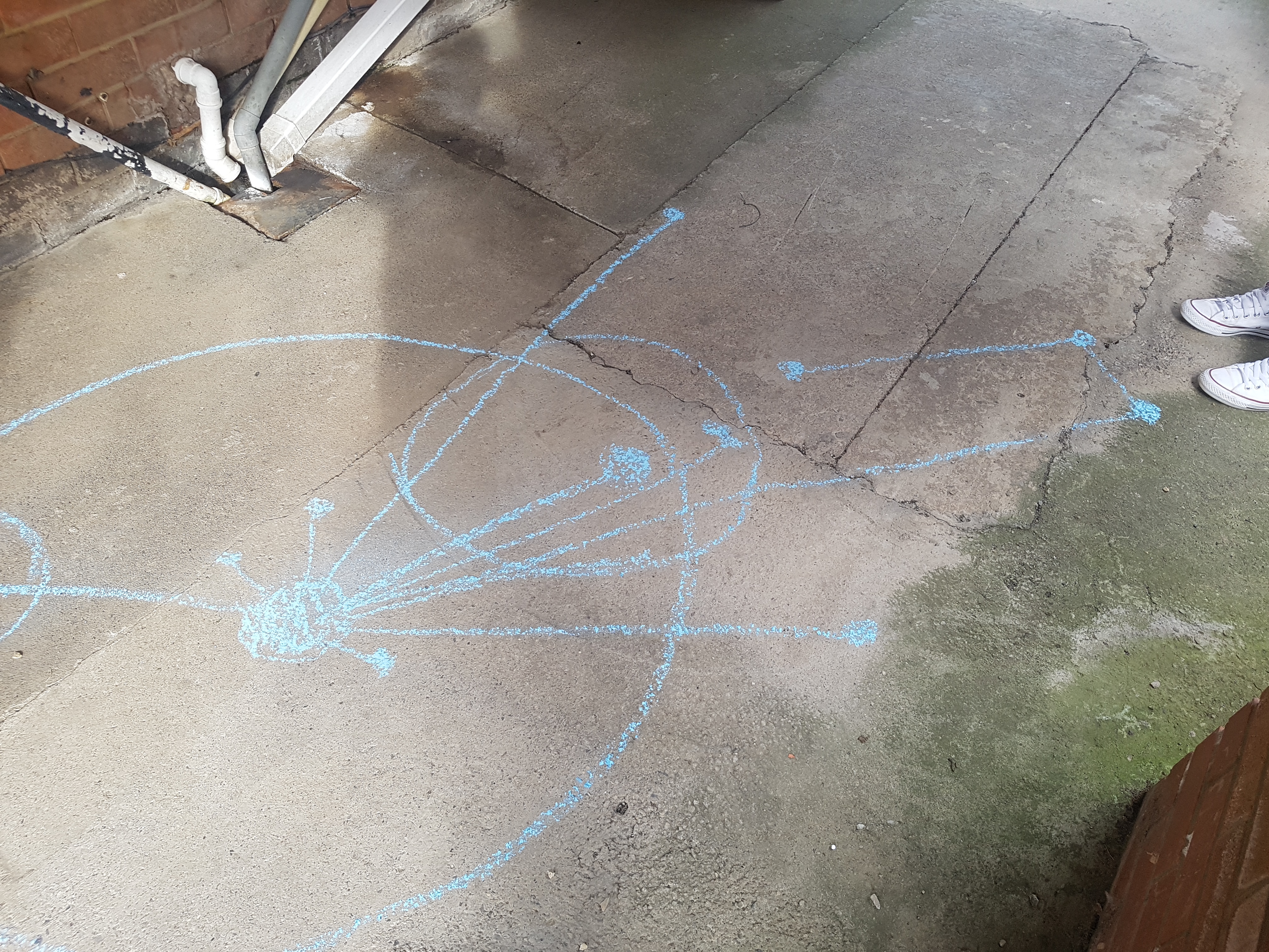
Result: An abstract interpretation of Skippers Lane, showcasing it’s unique history and connections around the world via the part it played in transporting the Iron Ore. Use of lines and circles to portray connections and wholeness of the current community that Skippers Lane hosts.
Original 3 points of interest. Local reliability to Skippers Lane street. 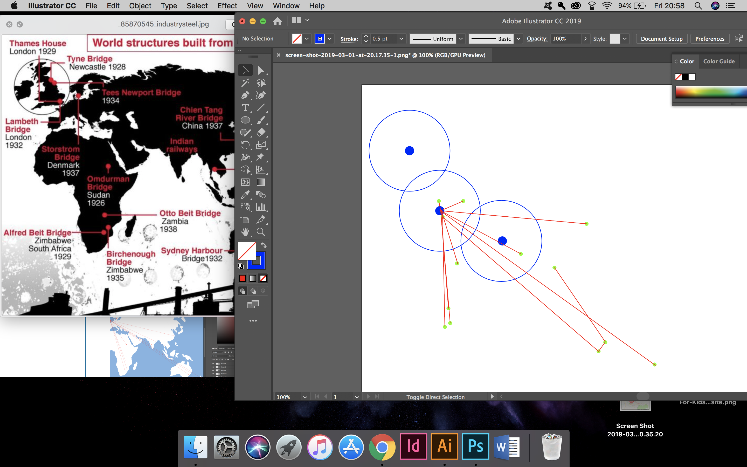
Originally did Skippers Lane street alone as circumference 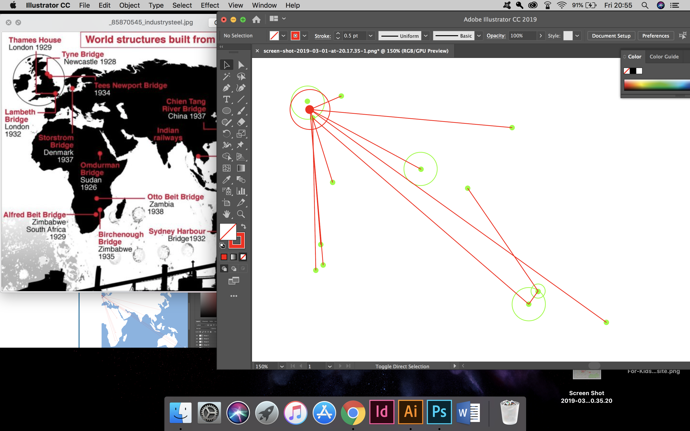
Skippers Lane street to world connections, tidied up and scaled down 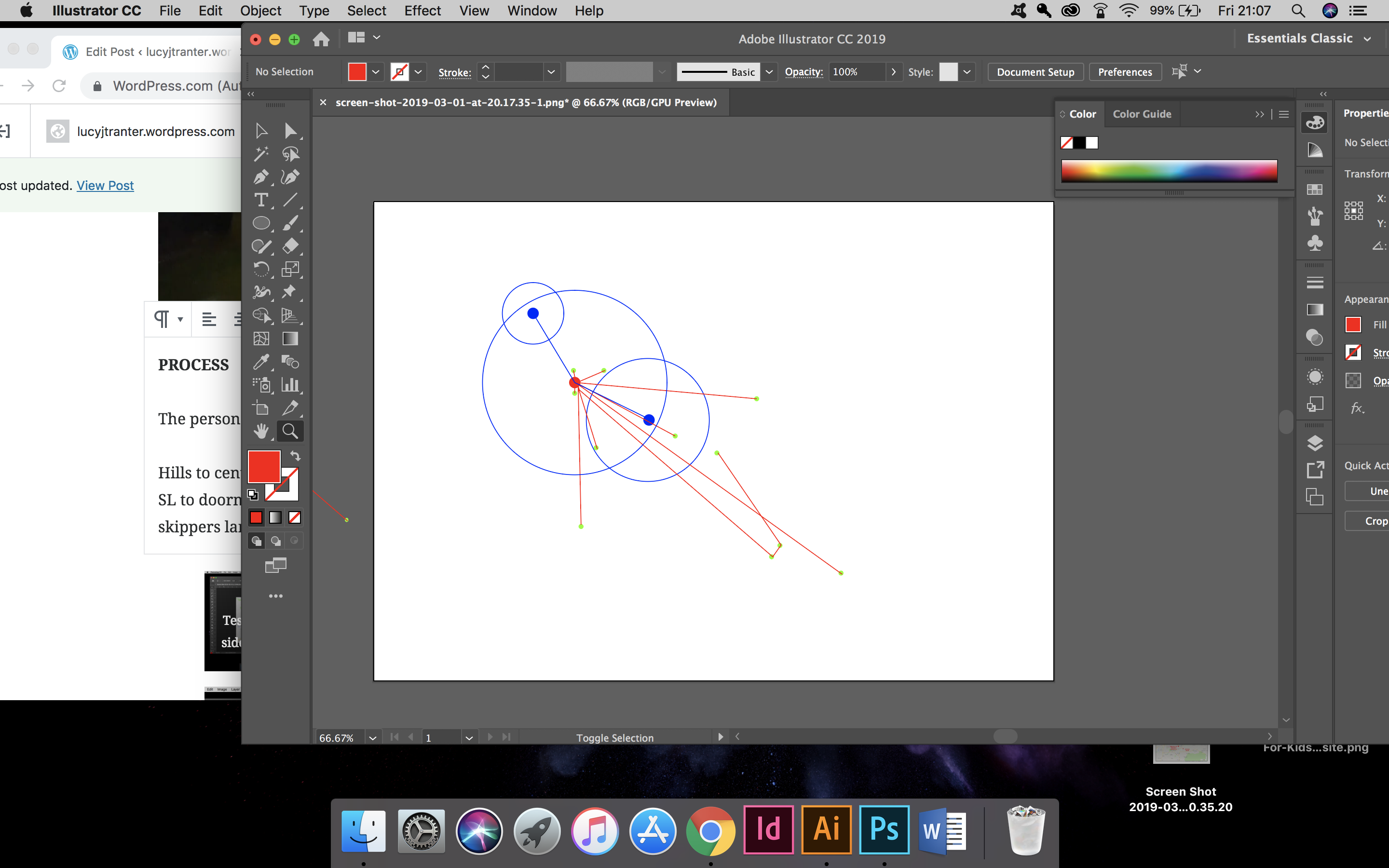
Decided to expand to whole of ‘Skippers Lane’ for circumference 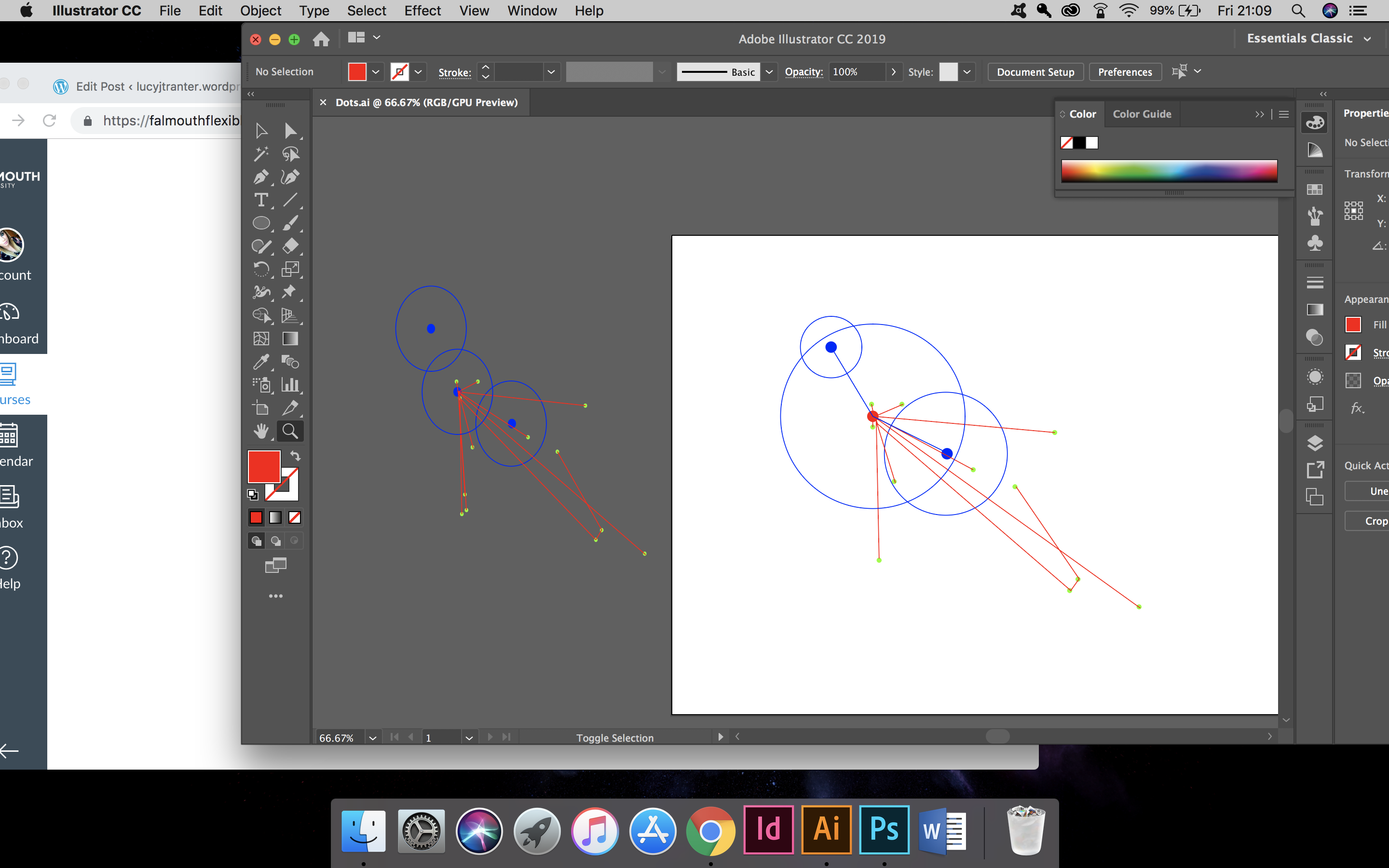
Adding the world connections to the local connections. 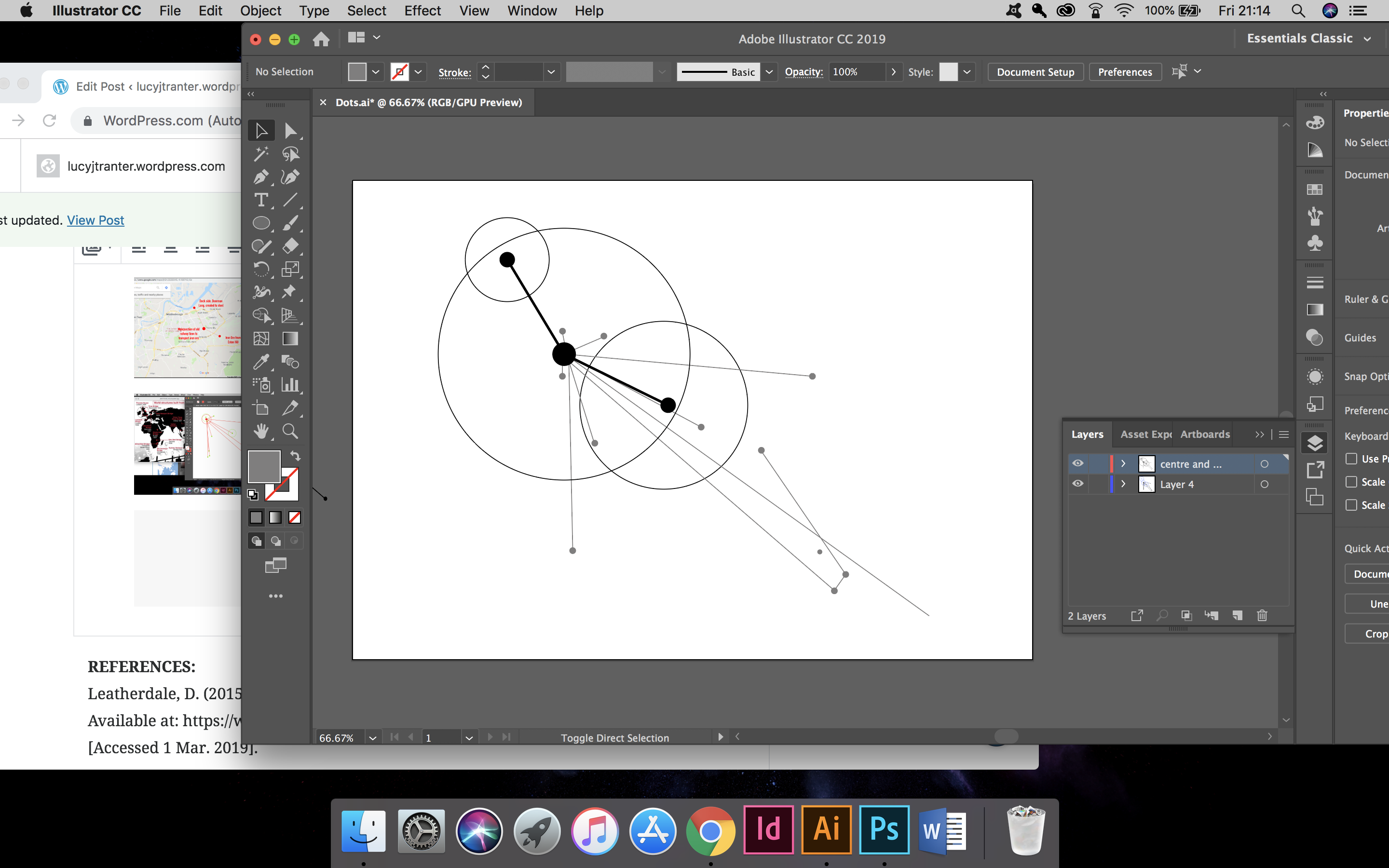
Changing to a black only system. 
Black system to portray original connections to Skippers Lane. Grey to differentiate the world connections to Skippers Lane.
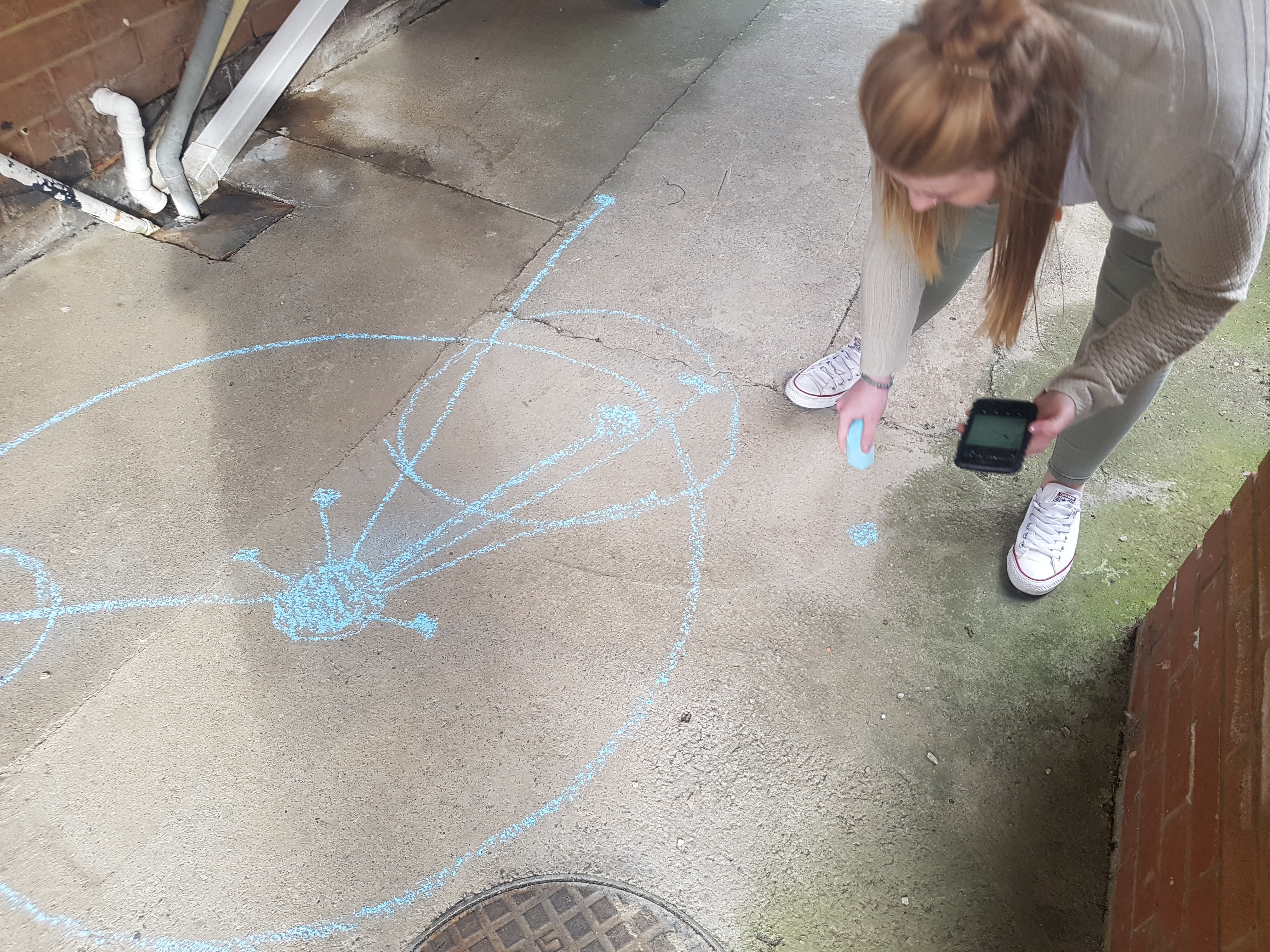
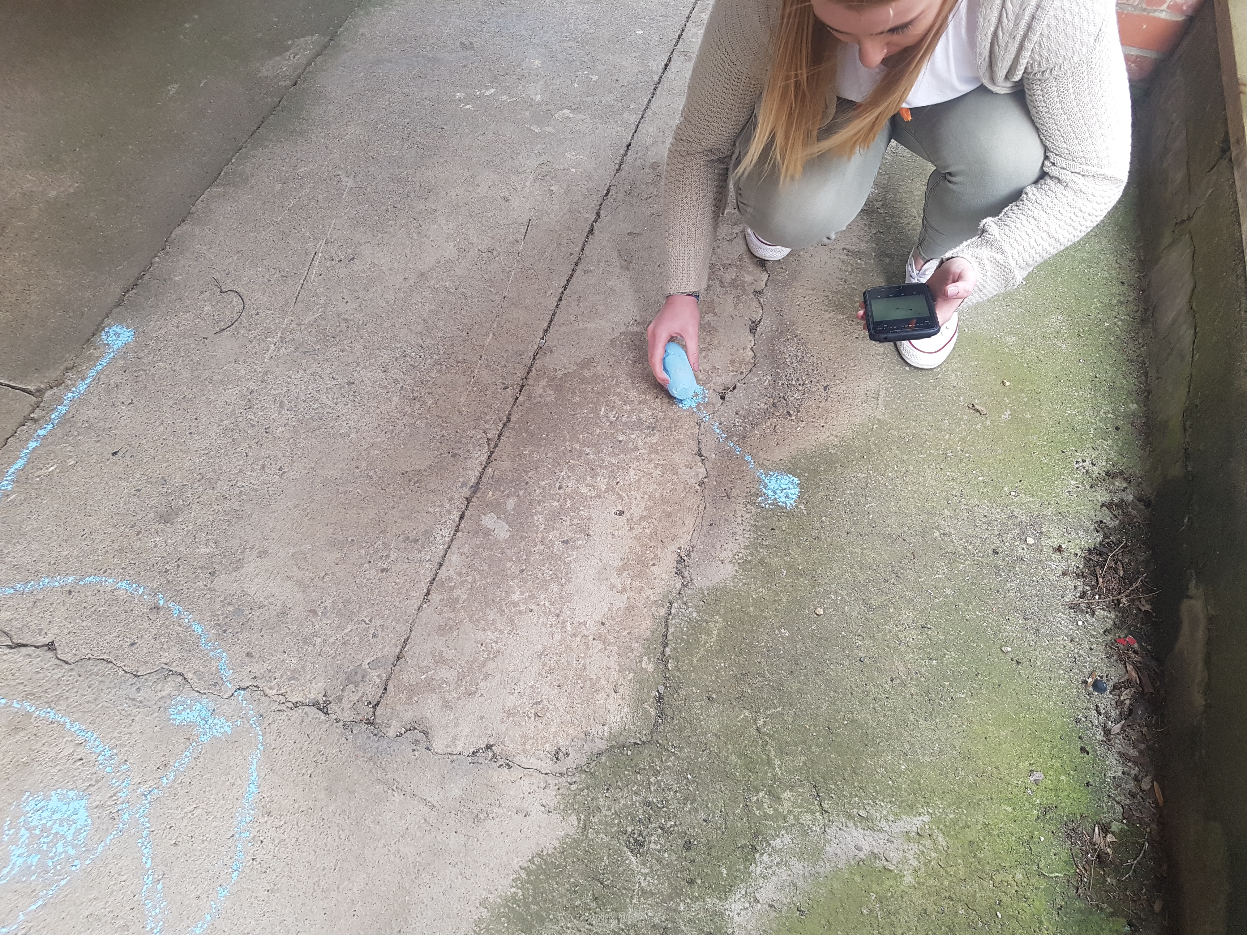
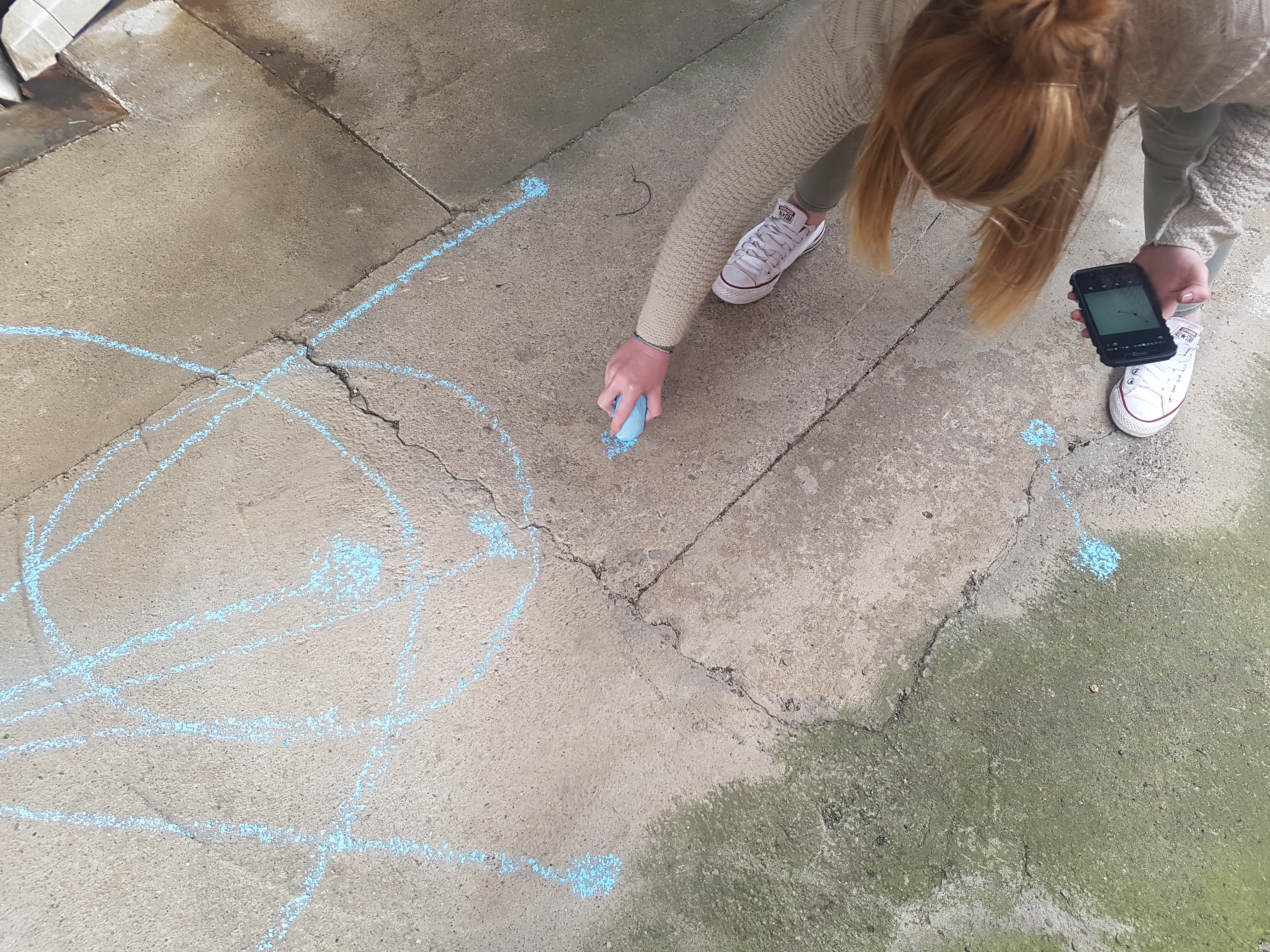
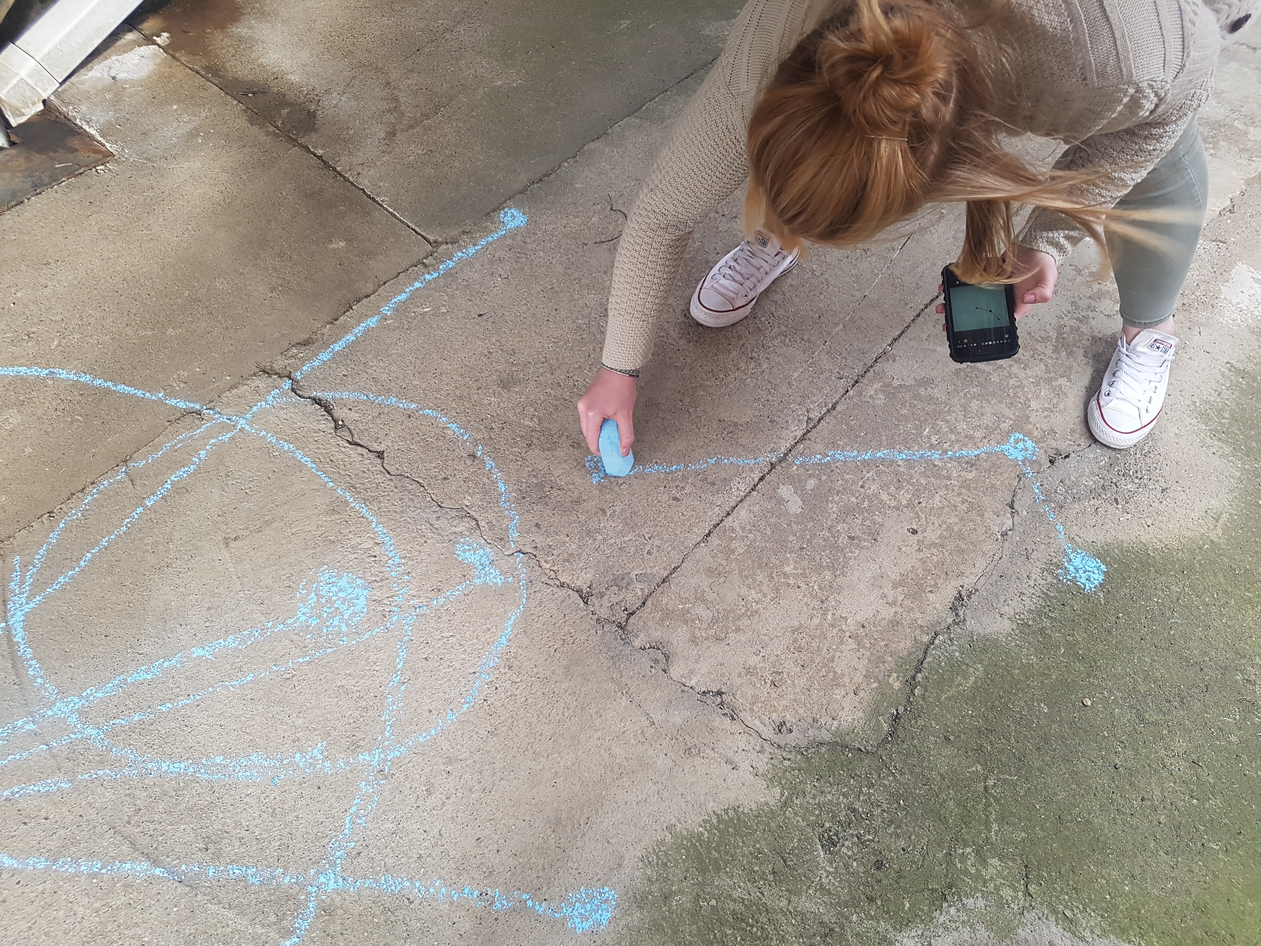
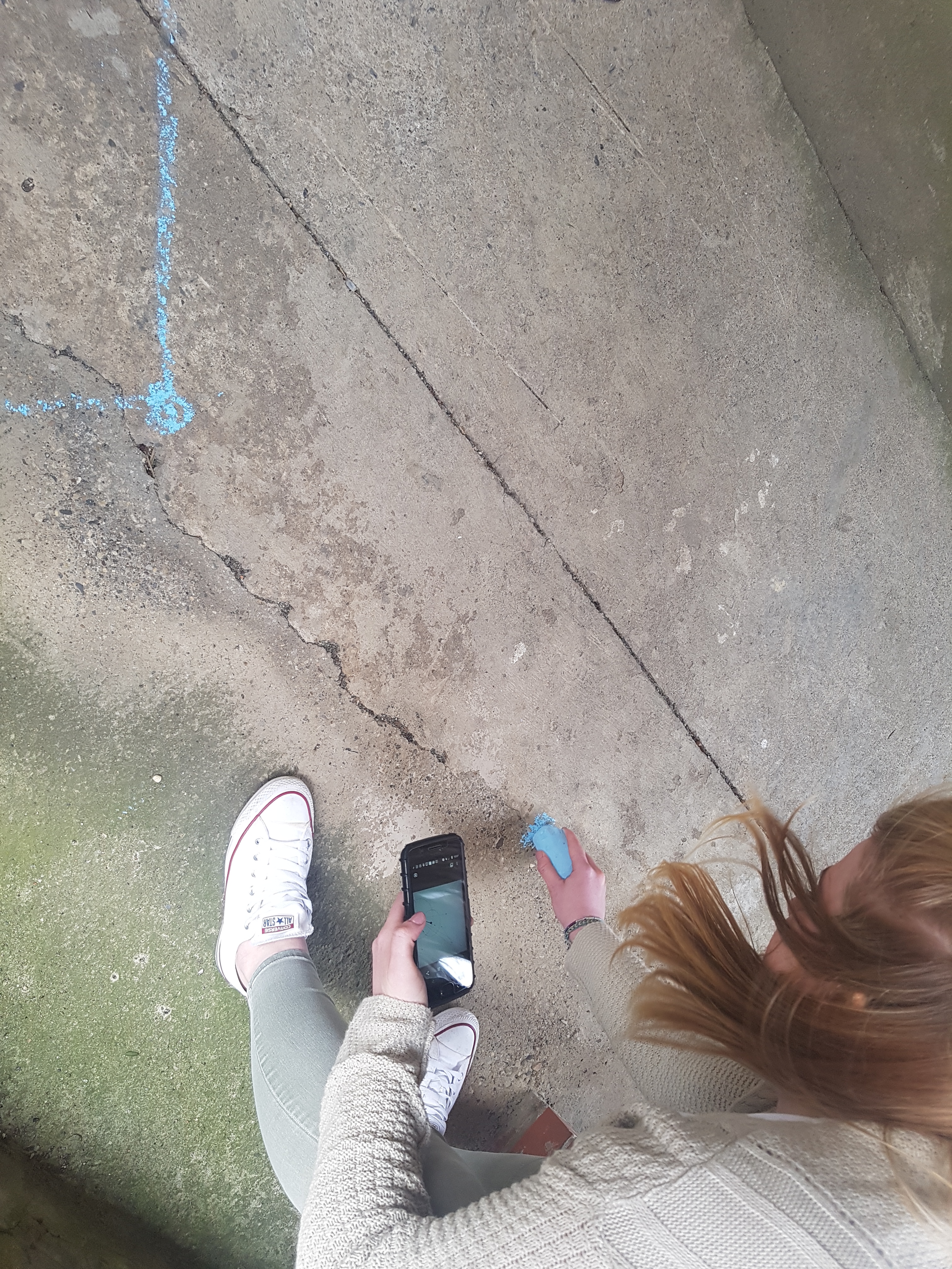
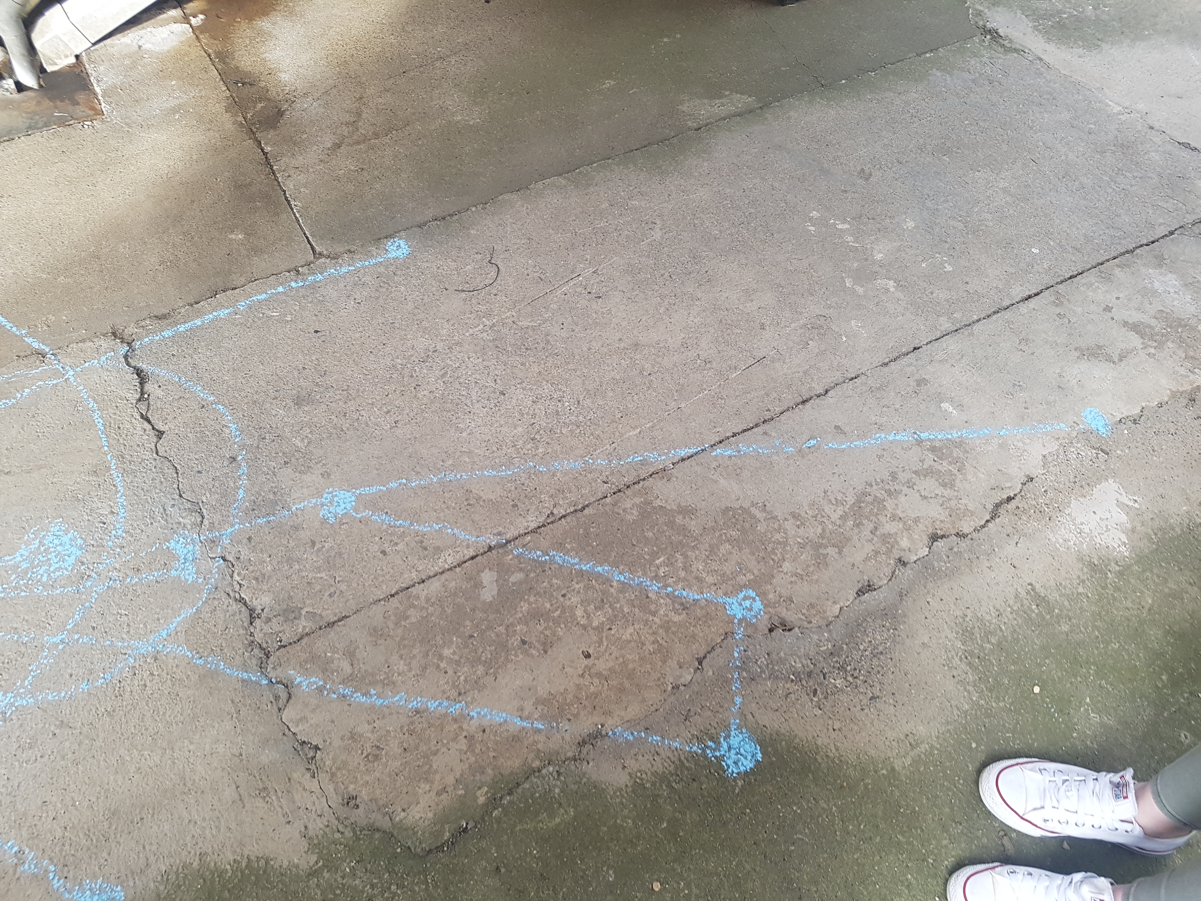
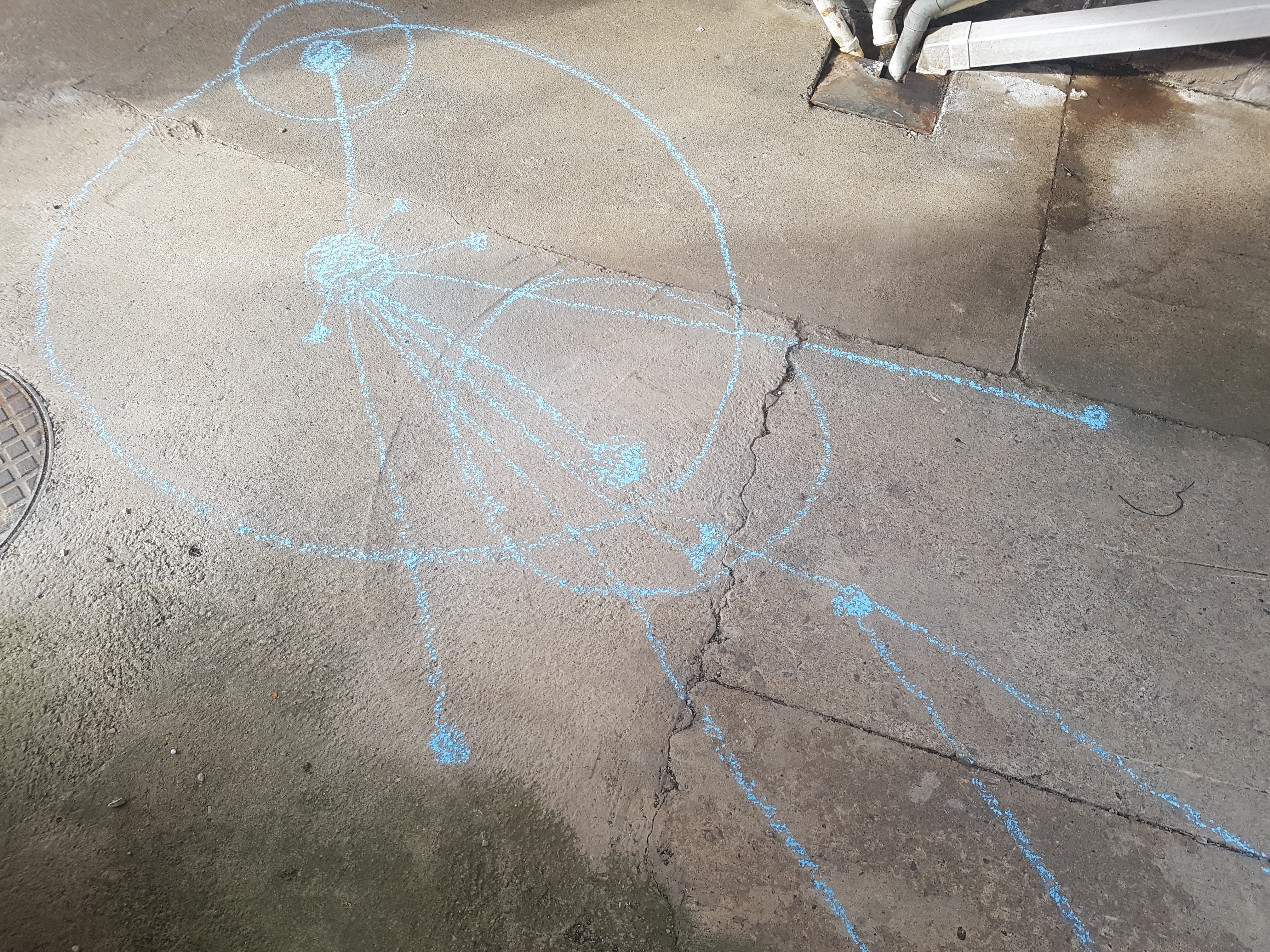
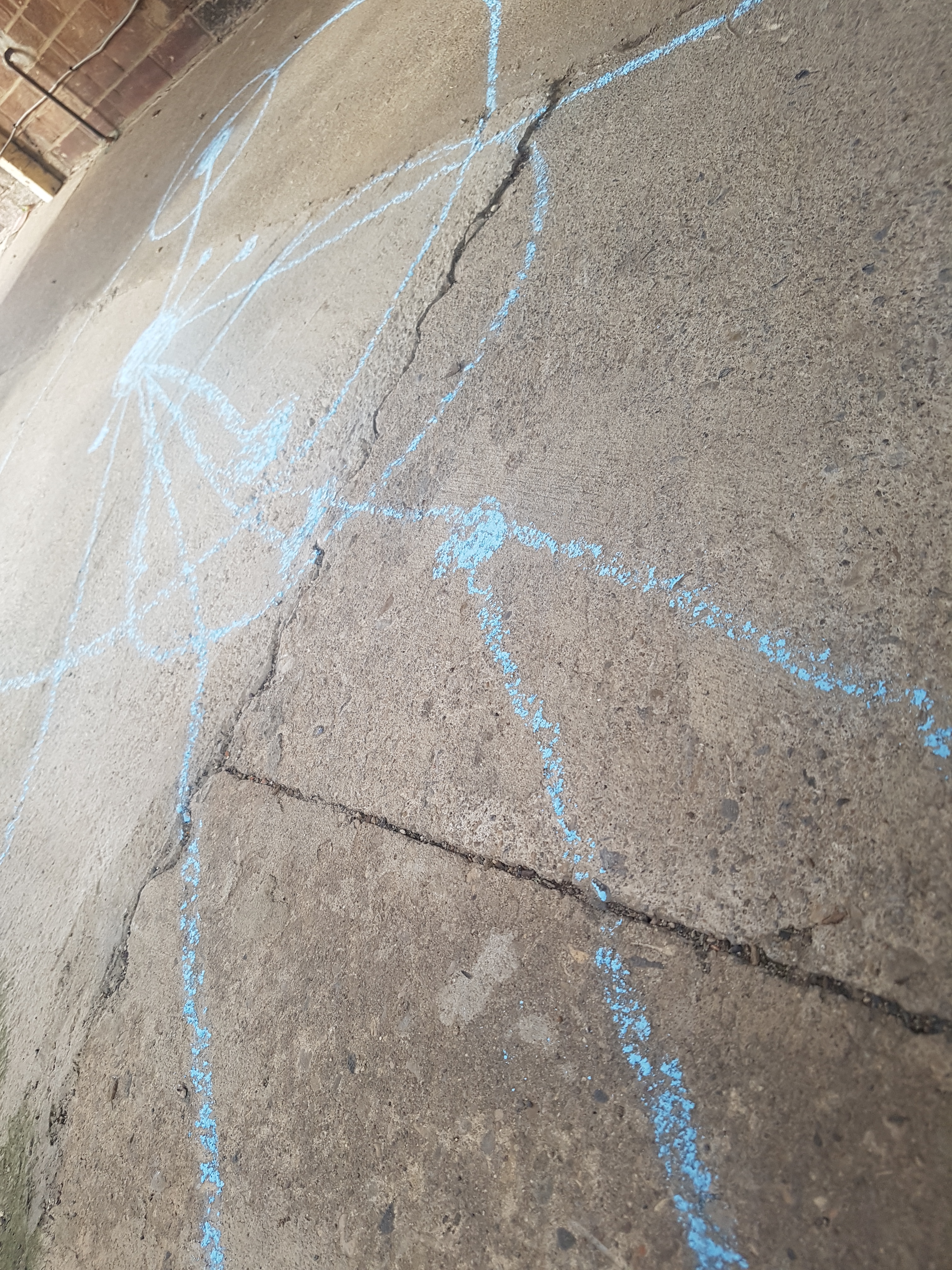
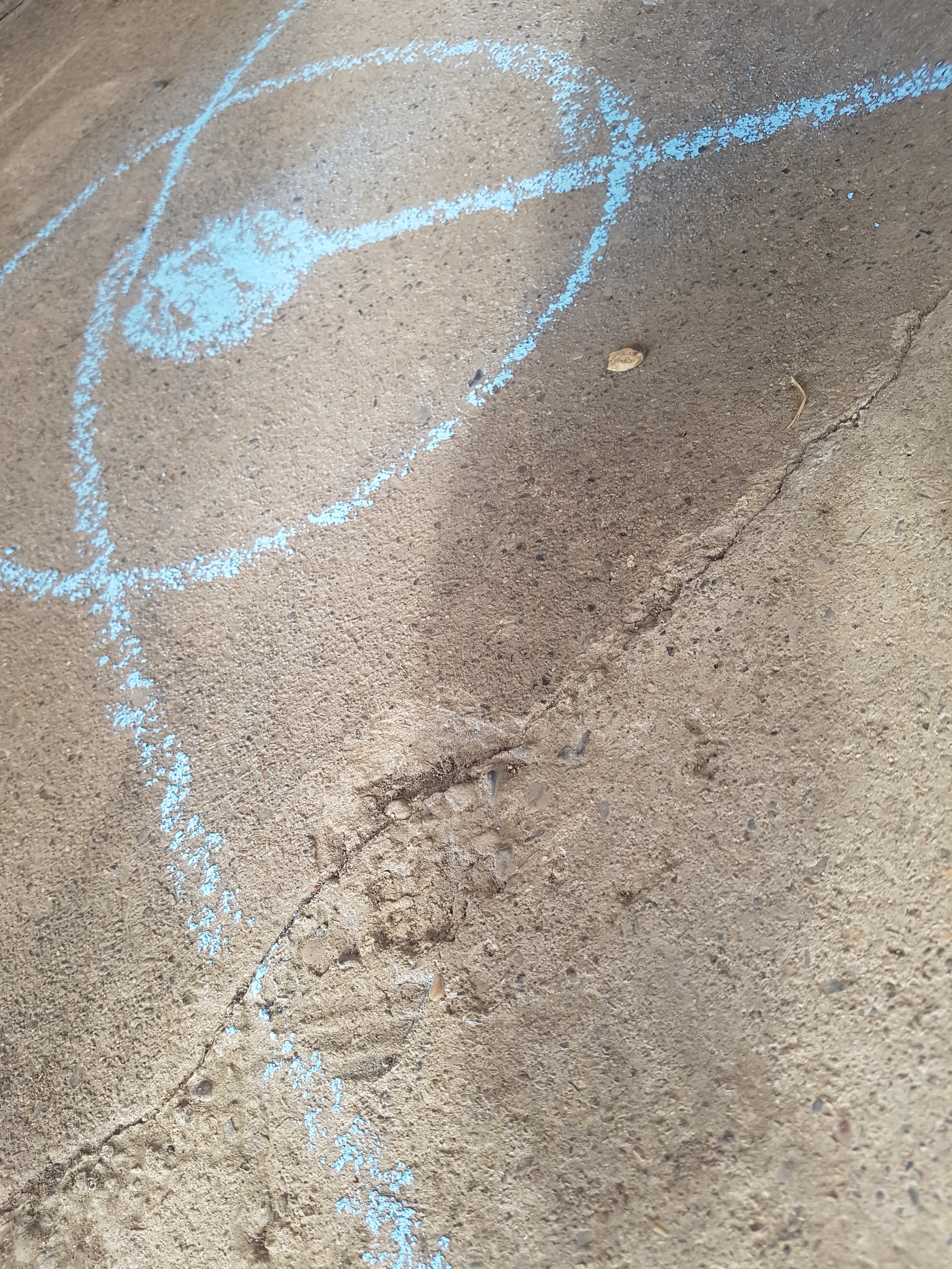
The abstract design was unique and looked visually interesting, but I wanted it to have more meaning and to some extent as an instalment for awareness. My initial idea was to recreate the design onto the Skippers Lane street using a substance that would gradually fade, mimicking the recognition for the street’s history. The abstract map design would face north, so all points of reference pointed to the correct direction. It would be central on the road, so it would be well seen by the public and in turn create discussion and curiosity.
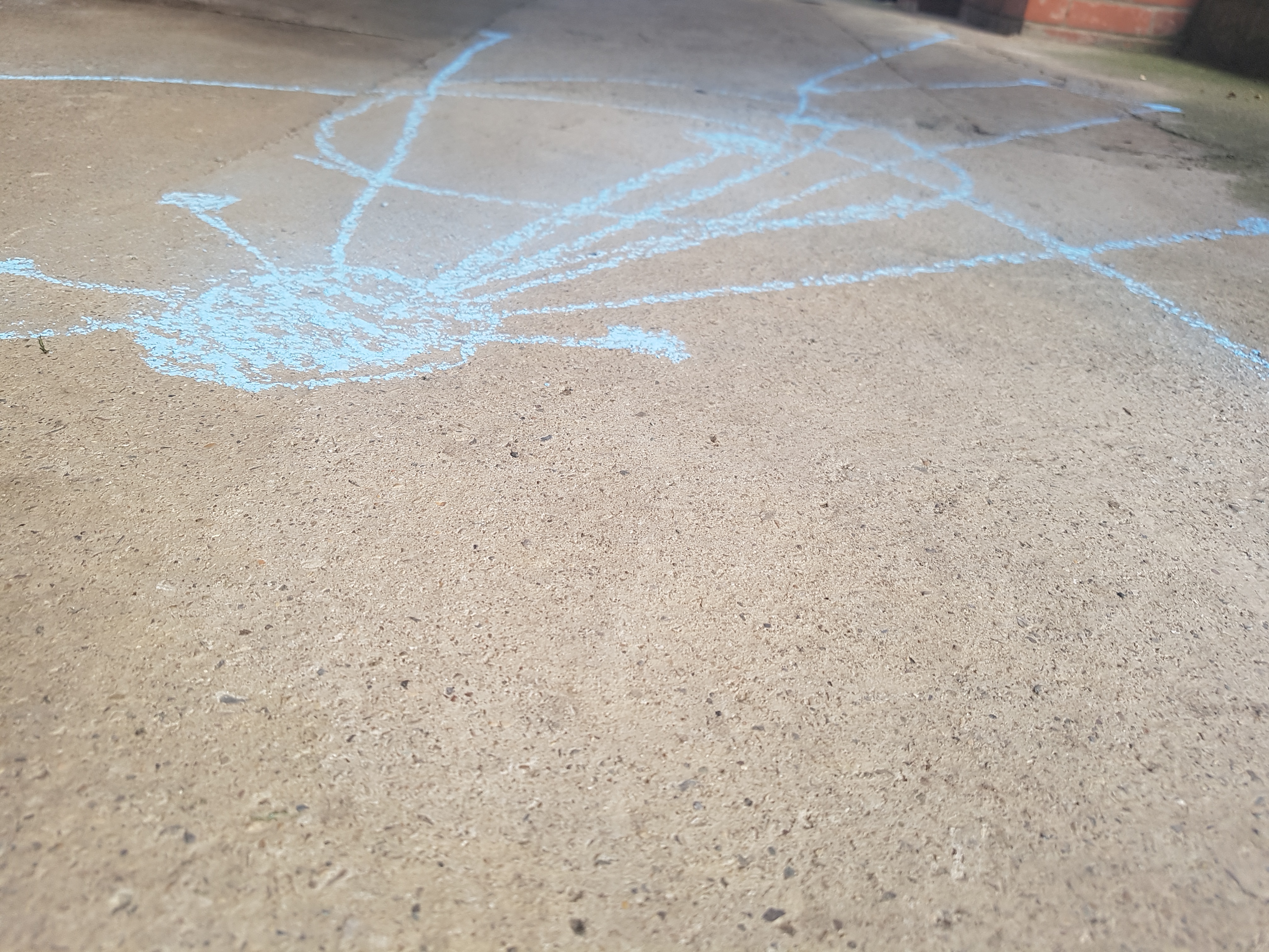
Originally I was going to use chalk, as over time this would fade. Then I soon discovered that this is classed as vandalism and if I didn’t stop I’d get a nasty fine (thanks Cleveland Police – oops). So, the next best thing was my drive unfortunately. My next idea was to recreate it using water and do a time lapse of it fading – then, it rained…
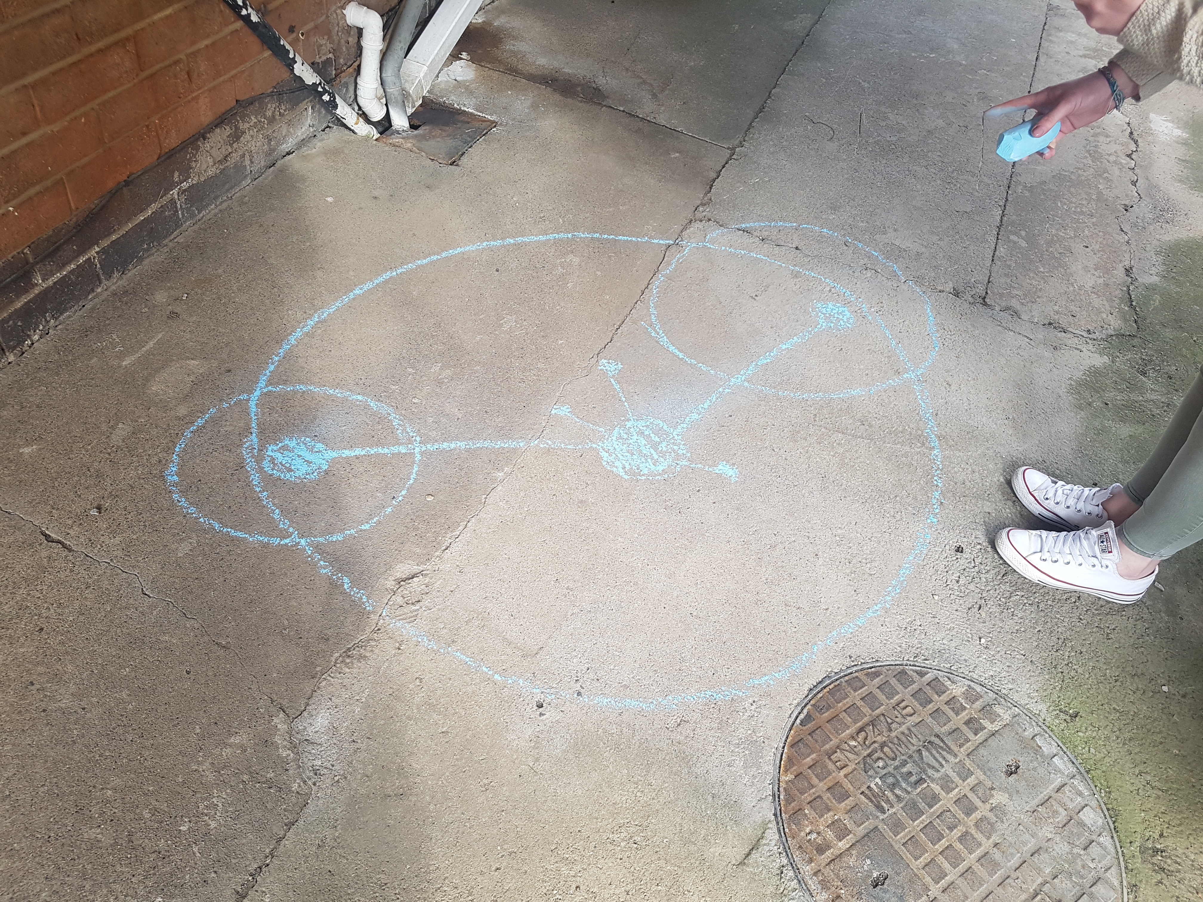
White chalk would have been better in my opinion to avoid confusing the meaning in regards to colour psychology – but could only find blue chalk. 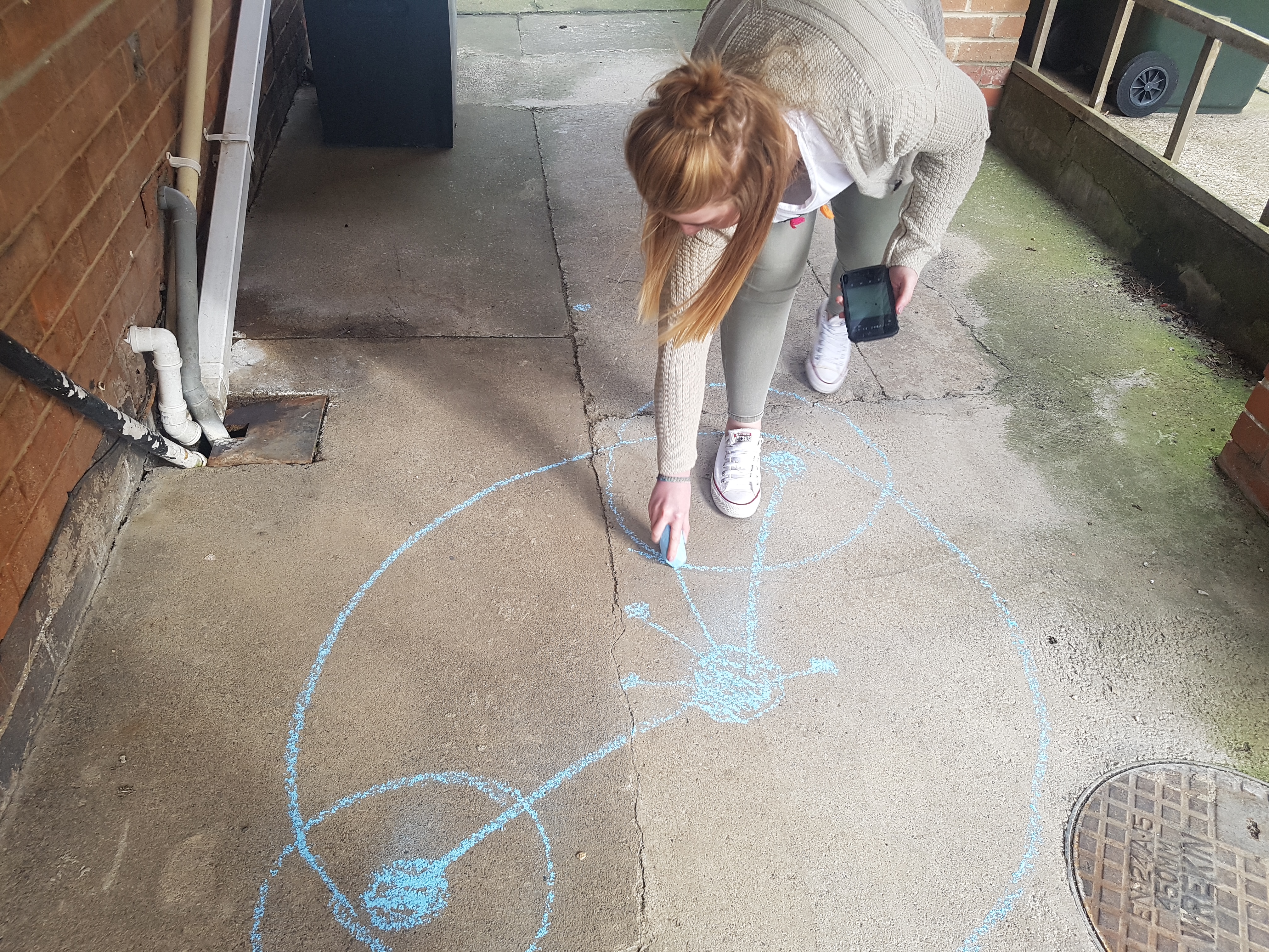
Using the abstract map on a phone screen for reference. 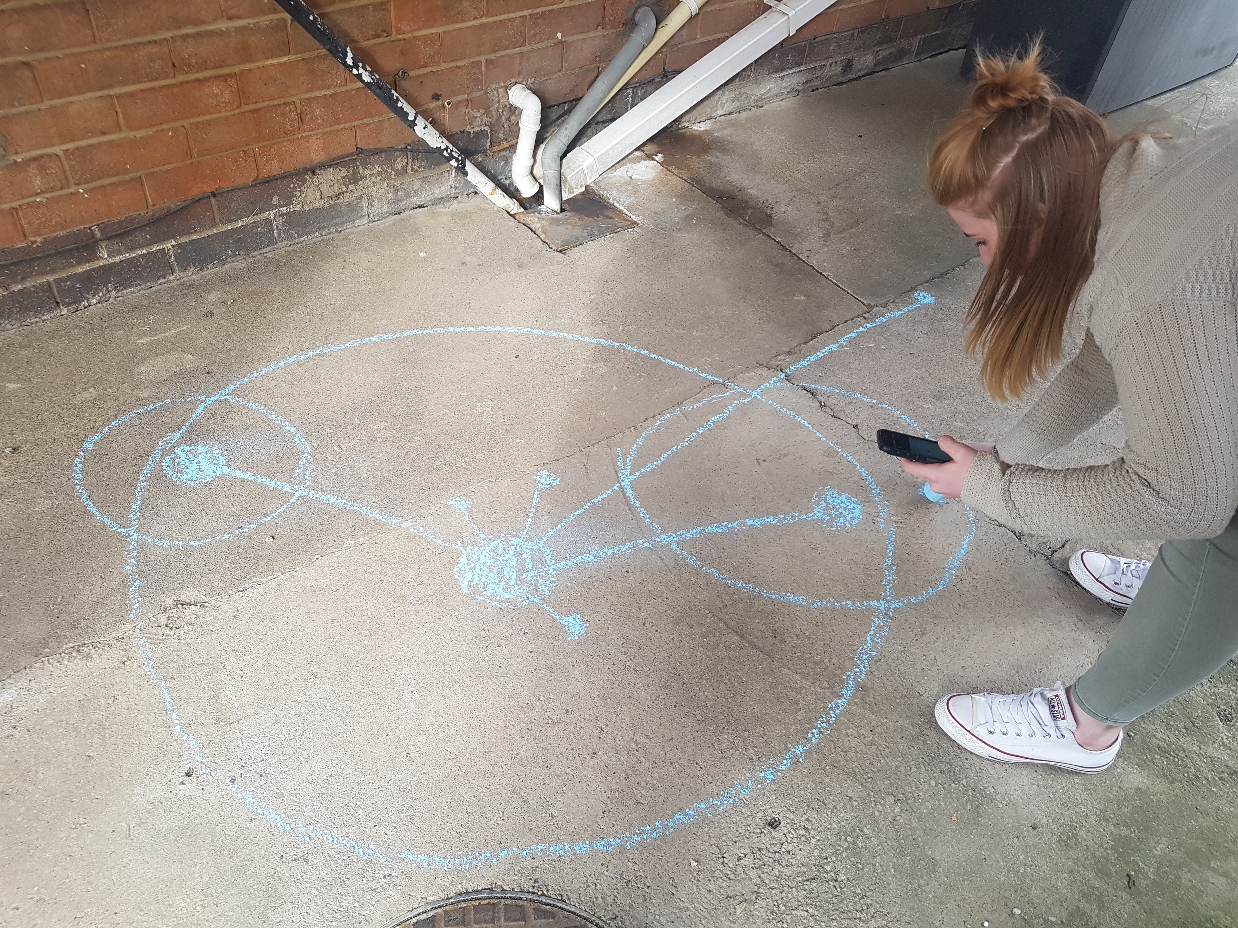

REFLECTION:
I had to develop this idea in less than 5 hours due to me going to Berlin for the duration of the week with 30 students, so no work will be getting complete then I’m afraid! In regards to what I’ve managed to gather and produce in the time available, I’m pleased and feel it was a success in that respect, however I can’t help feel it’s unfinished and naturally, a rushed idea.
My interpretation of the road and idea / concept could have been developed a lot further. I would have liked the chance to experiment a lot further and think of a range of ideas, using elements within the street. I perhaps could have made the idea a lot clearer and straight forward, as currently I think it’s a bit confusing. But in simple terms the interpretation is:
Modern day street with an ‘in line’ society. Historical elements of street forgotten, that actually link the street to a wide variety of areas within the world. The design elements are based on line work and structure due to visual observations of street, as well as metaphorical representations of the street community.
In addition to this I would have preferred to have had more time working out the mathematical side of my abstract map, with the scaling and relevant measurements all following the same process to achieve them. The local section of the map is worked out a lot more efficiently, whereas the world version is a lot more approximation. As well as this I would have liked to have created the physical version using real scale measurements, rather than just guess work and copying from a screen. For a more precise result, certainly a lot more planning was needed!
Finally, again, it would have been good to experiment further with the actual abstract map output. Considering other elements to portray the fading aspect, or on the other hand, one that would be a constant reminder to the public.
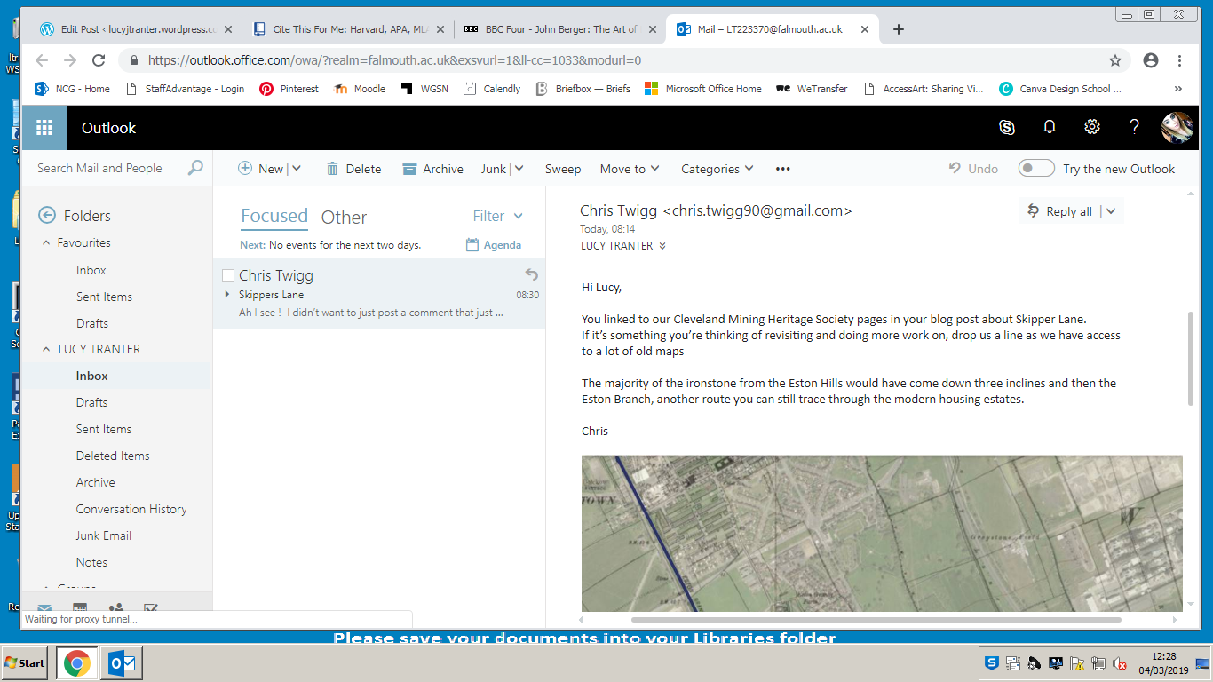
I believe in terms of my thought process, this is very different for me, usually I go for the obvious, this whole task has made me step out my comfort zone and make me slightly nervous writing up this post. I think this idea had potential overall and a variety of options that could have been taken, something to consider revisiting in the future if there is time. After I had initially written this post, I received an email screenshot below which could prove useful in the future for further research!